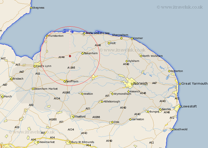
Norfolk Map Showing Location of East Rudham
Population: 525
District: King's Lynn and West Norfolk
Easting: 583051 Northing: 327846
Latitude: 52.82 Longitude: 0.72
 = East Rudham
District: King's Lynn and West Norfolk
Easting: 583051 Northing: 327846
Latitude: 52.82 Longitude: 0.72
= East Rudham
This East Rudham map below is supplied by Google. Use the tools in the top left corner to zoom into street level or zoom out for a road map, you may also need to zoom in to see East Rudham on the map. Click and drag the map to move around. If the map fails to load try and refresh your browser or zoom in or out (+ or -).
Update - it seems Google no longer allow people to use their maps for free! This East Rudham map sometimes loads and sometimes gives a error. I am working on a solution.
Closest 30 Towns or Cities to East Rudham (Population over 500)
Tattersett 2.16km Tatterset 2.16km Syderstone 3.7km Great Massingham 6.5km Massingham 6.5km Bircham 6.71km Great Bircham 6.71km Sculthorpe 7.67km Fakenham 8.05km South Creake 8.13km Colkirk 9.15km Docking 11.44km Litcham 12.45km Grimston 12.51km Little Snoring 12.86km Mileham 12.9km Castle Acre 13.17km Little Walsingham 13.42km Walsingham 13.42km Ryburgh 13.44km Great Ryburgh 13.44km Sedgeford 14.53km Ingoldisthorpe 14.54km Ingoldesthorpe 14.54km Gayton 14.55km Burnham Market 14.86km Dersingham 15.02km Snettisham 15.58km Great Palgrave 16.72km Palgrave 16.72km