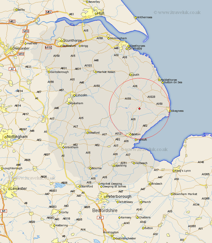
Lincolnshire Map Showing Location of East Keal
Population: 368
District: East Lindsey
Easting: 538191 Northing: 363456
Latitude: 53.15 Longitude: 0.07
 = East Keal
District: East Lindsey
Easting: 538191 Northing: 363456
Latitude: 53.15 Longitude: 0.07
= East Keal
This East Keal map below is supplied by Google. Use the tools in the top left corner to zoom into street level or zoom out for a road map, you may also need to zoom in to see East Keal on the map. Click and drag the map to move around. If the map fails to load try and refresh your browser or zoom in or out (+ or -).
Update - it seems Google no longer allow people to use their maps for free! This East Keal map sometimes loads and sometimes gives a error. I am working on a solution.
Closest 30 Towns or Cities to East Keal (Population over 500)
Spilsby 4.32km Stickney 8.13km Mareham 9.63km Mareham on the Hill 9.63km Mareham-on-the-Hill 9.63km Carrington 10.75km Willoughby 11.57km Friskney 12.1km Burgh le Marsh 12.23km Croft 12.37km Wrangle 13.4km Sibsey 13.4km Horncastle 13.42km Banovallum 13.42km Wainfleet All Saints 13.44km Wainfleet 13.44km Alford 13.57km Frithville 14.59km Old Leake 14.99km Leake 14.99km Coningsby 16km Leverton 16.72km Huttoft 17.35km Ingoldmells 18.16km Chapel St. Leonards 18.24km Chapel St Leonards 18.24km Chapel Saint Leonards 18.24km Butterwick 18.54km Bennington 18.57km Benington 18.57km