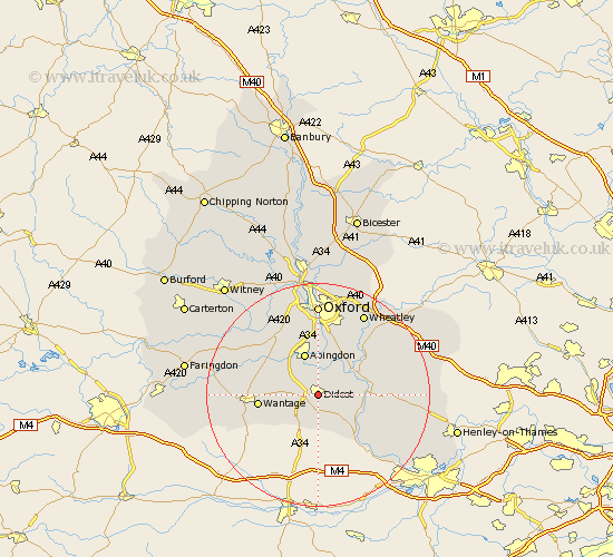
Oxfordshire Map Showing Location of Didcot
Population: 17344
Area Size (ha): 813
District: South Oxfordshire
Easting: 451940 Northing: 189336
Latitude: 51.6 Longitude: -1.25
 = Didcot
Area Size (ha): 813
District: South Oxfordshire
Easting: 451940 Northing: 189336
Latitude: 51.6 Longitude: -1.25
= Didcot
This Didcot map below is supplied by Google. Use the tools in the top left corner to zoom into street level or zoom out for a road map, you may also need to zoom in to see Didcot on the map. Click and drag the map to move around. If the map fails to load try and refresh your browser or zoom in or out (+ or -).
Update - it seems Google no longer allow people to use their maps for free! This Didcot map sometimes loads and sometimes gives a error. I am working on a solution.
Closest 30 Towns or Cities to Didcot (Population over 500)
Hagbourne 2.18km East Hagbourne 2.18km Harwell 2.3km Sutton Courtenay 3.88km Long Wittenham 3.88km Milton 3.92km Steventon 4.97km Drayton 5.06km Blewbury 5.68km Chilton 5.68km Clifton Hampden 6.54km Dorchester 6.84km Abingdon 7.77km Abingdon on Thames 7.77km Abingdon-on-Thames 7.77km Cholsey 7.84km Marcham 8km Wallingford 8.06km Warborough 8.27km Radley 9.34km Sunningwell 9.54km Drayton 9.79km Drayton Saint Leonard 9.79km Drayton St Leonard 9.79km Drayton St. Leonard 9.79km Benson 9.92km Moulsford 10.14km Hanney 10.52km East Hanney 10.52km Wantage 10.53km