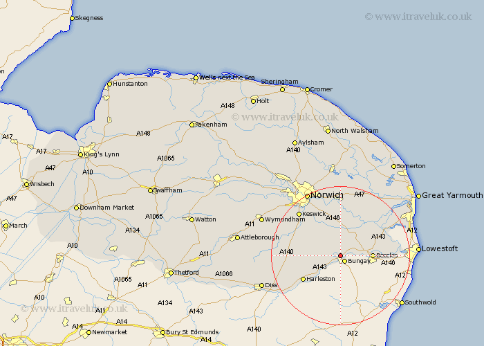
Norfolk Map Showing Location of Ditchingham
Population: 1928
Area Size (ha): 89
District: South Norfolk
Easting: 633182 Northing: 291002
Latitude: 52.47 Longitude: 1.43
 = Ditchingham
Area Size (ha): 89
District: South Norfolk
Easting: 633182 Northing: 291002
Latitude: 52.47 Longitude: 1.43
= Ditchingham
This Ditchingham map below is supplied by Google. Use the tools in the top left corner to zoom into street level or zoom out for a road map, you may also need to zoom in to see Ditchingham on the map. Click and drag the map to move around. If the map fails to load try and refresh your browser or zoom in or out (+ or -).
Update - it seems Google no longer allow people to use their maps for free! This Ditchingham map sometimes loads and sometimes gives a error. I am working on a solution.
Closest 30 Towns or Cities to Ditchingham (Population over 500)
Earsham 2.17km Ellingham 3.39km Loddon 6km Chedgrave 8.67km Thurton 9.26km Hempnall 9.76km Brooke 9.86km Poringland 10.84km Thurlton 11.67km Cantley 12.47km Harleston 12.59km Stoke Holy Cross 12.93km Reedham 12.93km Saxlingham 13.49km Saxlingham Thorpe 13.49km Pulham 13.61km Long Stratton 13.67km Freethorpe 15.18km Fritton 15.43km Brockdish 15.86km Forncett Saint Mary 16.23km Forncett St Mary 16.23km Forncett 16.23km Forncett St. Mary 16.23km Mulbarton 16.4km Swardeston 16.66km Brundall 16.68km Blofield 16.72km Great Moulton 16.93km Moulton 16.93km