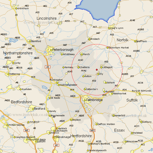
Cambridgeshire Map Showing Location of Downham
Population: 2409
District: East Cambridgeshire
Easting: 552943 Northing: 284125
Latitude: 52.43 Longitude: 0.25
 = Downham
District: East Cambridgeshire
Easting: 552943 Northing: 284125
Latitude: 52.43 Longitude: 0.25
= Downham
This Downham map below is supplied by Google. Use the tools in the top left corner to zoom into street level or zoom out for a road map, you may also need to zoom in to see Downham on the map. Click and drag the map to move around. If the map fails to load try and refresh your browser or zoom in or out (+ or -).
Update - it seems Google no longer allow people to use their maps for free! This Downham map sometimes loads and sometimes gives a error. I am working on a solution.
Closest 30 Towns or Cities to Downham (Population over 500)
Littleport 3.86km Ely 3.87km Witchford 6.51km Manea 7.17km Stretham 7.74km Mepal 9.77km Wilburton 10.85km Haddenham 11.48km Sutton 11.6km Soham 13.03km Doddington 13.61km Chatteris 13.68km Wimblington 14.47km Wicken 15.21km Isleham 15.86km March 17.2km Colne 17.48km Somersham 17.85km Willingham 17.97km Fordham 17.98km Earith 18.34km Bluntisham 18.34km Cottenham 18.98km Chippenham 19.36km Burwell 19.37km Over 20.47km Swaffham Prior 20.66km Waterbeach 20.88km Long Stanton 21.51km Warboys 21.79km