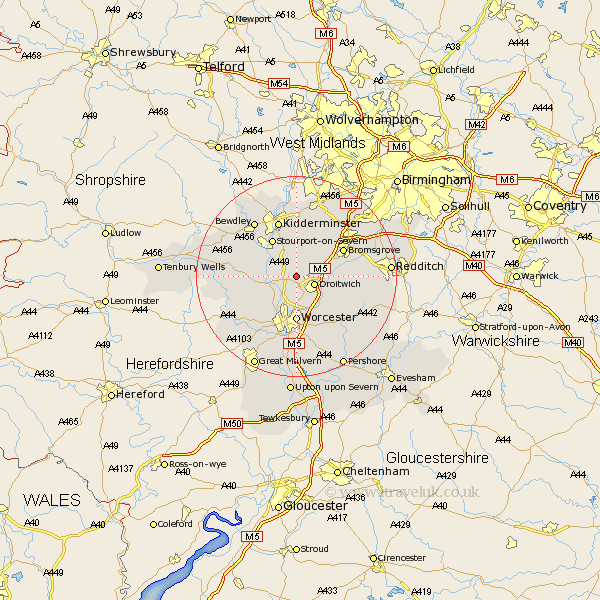
Worcestershire Map Showing Location of Doverdale
Population: 47
District: Wychavon
Easting: 386358 Northing: 265080
Latitude: 52.28 Longitude: -2.2
 = Doverdale
District: Wychavon
Easting: 386358 Northing: 265080
Latitude: 52.28 Longitude: -2.2
= Doverdale
This Doverdale map below is supplied by Google. Use the tools in the top left corner to zoom into street level or zoom out for a road map, you may also need to zoom in to see Doverdale on the map. Click and drag the map to move around. If the map fails to load try and refresh your browser or zoom in or out (+ or -).
Update - it seems Google no longer allow people to use their maps for free! This Doverdale map sometimes loads and sometimes gives a error. I am working on a solution.
Closest 30 Towns or Cities to Doverdale (Population over 500)
Ombersley 2.92km Droitwich 3.87km Holt 5.03km Fernhill Heath 5.56km Hartlebury 6km Grimley 6.52km Chaddesley Corbett 7.75km Astley 8.15km Hallow 8.15km Stourport on Severn 8.69km Stourport 8.69km Stourport-on-Severn 8.69km Stoke Prior 9.26km Worcester 9.26km Stone 9.27km Great Dodford 10.06km Dodford 10.06km Great Witley 10.2km Hanbury 10.37km Bromsgrove 10.63km Crowle 10.86km Abberley 11.49km Kidderminster 11.63km Martley 12.63km Powick 13.41km Bewdley 13.66km Leigh 13.67km Lickey End 13.78km Lickey 13.78km Belbroughton 14.16km