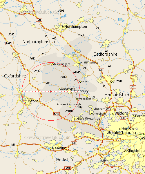
Buckinghamshire Map Showing Location of Dorton
Population: 163
District: Aylesbury Vale
Easting: 468923 Northing: 213641
Latitude: 51.82 Longitude: -1
 = Dorton
District: Aylesbury Vale
Easting: 468923 Northing: 213641
Latitude: 51.82 Longitude: -1
= Dorton
This Dorton map below is supplied by Google. Use the tools in the top left corner to zoom into street level or zoom out for a road map, you may also need to zoom in to see Dorton on the map. Click and drag the map to move around. If the map fails to load try and refresh your browser or zoom in or out (+ or -).
Update - it seems Google no longer allow people to use their maps for free! This Dorton map sometimes loads and sometimes gives a error. I am working on a solution.
Closest 30 Towns or Cities to Dorton (Population over 500)
Brill 3.44km Oakley 4.95km Grendon Underwood 5.56km Long Crendon 5.68km Waddesdon 6.02km Chearsley 6.54km Cuddington 6.83km Warminghall 7.21km Worminghall 7.21km Quainton 7.98km Haddenham 7.98km Marsh Gibbon 9.88km Stone 10.48km North Marston 11.78km Steeple Claydon 13.02km Claydon 13.02km Twyford 13.17km Whitechurch 13.63km Whitchurch 13.63km Aylesbury 13.75km Longwick 13.87km Bledlow 14.42km Stoke Mandeville 15.35km Great Kimble 16.59km Kimble 16.59km Ellesborough 16.65km Gawcott 16.68km Princes Risborough 16.82km Padbury 17.03km Winslow 17.42km