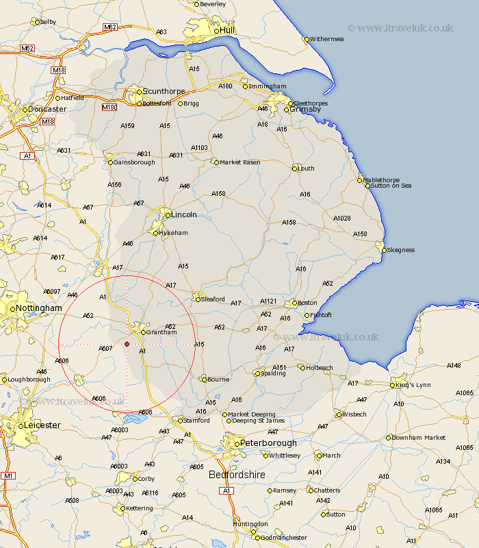
Lincolnshire Map Showing Location of Denton
Population: 283
District: South Kesteven
Easting: 487501 Northing: 330740
Latitude: 52.87 Longitude: -0.7
 = Denton
District: South Kesteven
Easting: 487501 Northing: 330740
Latitude: 52.87 Longitude: -0.7
= Denton
This Denton map below is supplied by Google. Use the tools in the top left corner to zoom into street level or zoom out for a road map, you may also need to zoom in to see Denton on the map. Click and drag the map to move around. If the map fails to load try and refresh your browser or zoom in or out (+ or -).
Update - it seems Google no longer allow people to use their maps for free! This Denton map sometimes loads and sometimes gives a error. I am working on a solution.
Closest 30 Towns or Cities to Denton (Population over 500)
Harlaxton 1.12km Barrowby 3.87km Grantham 5.81km Great Gonerby 5.99km Allington 7.49km Colsterworth 9.29km Belton 9.99km Long Bennington 11.61km Ropsley 12.44km South Witham 14.13km Corby 14.38km Ancaster 15.76km Caythorpe 17.98km Castle Bytham 18.59km Claypole 18.66km Fulbeck 20.11km Folkingham 20.14km Rippingale 23.07km Sleaford 24km Bourn 24.01km Bourne 24.01km Morton 24.24km Cranwell 24.24km Welbourn 24.4km Billingborough 24.68km Pointon 24.69km Leasingham 25.27km Heasingham 25.27km Brauncewell 27.1km Helpringham 27.83km