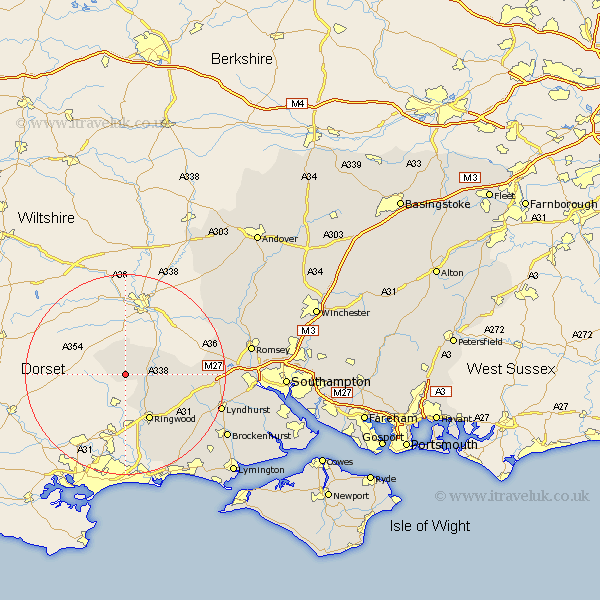
Hampshire Map Showing Location of Damerham
Population: 519
District: New Forest
Easting: 410539 Northing: 114944
Latitude: 50.93 Longitude: -1.85
 = Damerham
District: New Forest
Easting: 410539 Northing: 114944
Latitude: 50.93 Longitude: -1.85
= Damerham
This Damerham map below is supplied by Google. Use the tools in the top left corner to zoom into street level or zoom out for a road map, you may also need to zoom in to see Damerham on the map. Click and drag the map to move around. If the map fails to load try and refresh your browser or zoom in or out (+ or -).
Update - it seems Google no longer allow people to use their maps for free! This Damerham map sometimes loads and sometimes gives a error. I am working on a solution.
Closest 30 Towns or Cities to Damerham (Population over 500)
Fordingbridge 3.5km Sandleheath 6.03km Ibsley 7.26km Hale 8.38km Ringwood 10.38km Bramshaw 16.35km Burley 16.7km Minstead 18.39km Bransgore 18.58km Cadnam 18.78km West Wellow 19.05km Sopley 19.11km Sherfield English 19.49km Lyndhurst 20.11km Brockenhurst 23.73km Sway 24.21km Romsey 25.14km Totton 25.77km Eling 25.97km Milton 26.3km New Milton 26.3km Broughton 26.81km Hordle 26.9km Michlemersh 26.91km Michelmersh 26.91km Barton-on-Sea 27.31km Barton on Sea 27.31km Barton 27.31km Over Wallop 28.29km Nether Wallop 28.43km