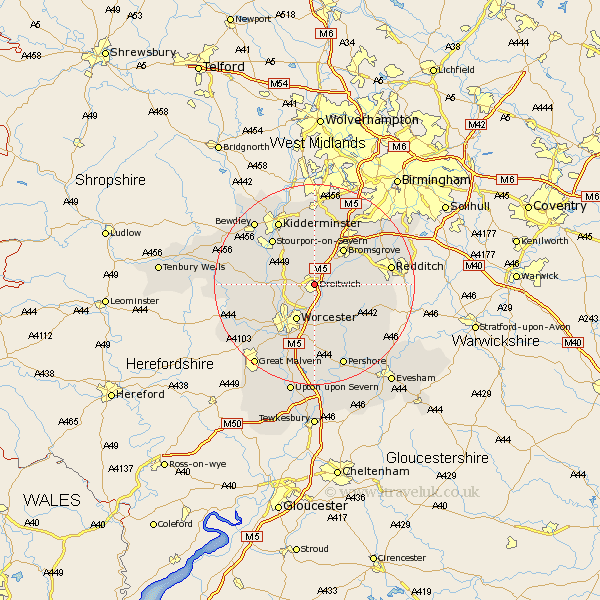
Worcestershire Map Showing Location of Droitwich
Population: 20709
Area Size (ha): 568
District: Wychavon
Easting: 389764 Northing: 263225
Latitude: 52.27 Longitude: -2.15
 = Droitwich
Area Size (ha): 568
District: Wychavon
Easting: 389764 Northing: 263225
Latitude: 52.27 Longitude: -2.15
= Droitwich
This Droitwich map below is supplied by Google. Use the tools in the top left corner to zoom into street level or zoom out for a road map, you may also need to zoom in to see Droitwich on the map. Click and drag the map to move around. If the map fails to load try and refresh your browser or zoom in or out (+ or -).
Update - it seems Google no longer allow people to use their maps for free! This Droitwich map sometimes loads and sometimes gives a error. I am working on a solution.
Closest 30 Towns or Cities to Droitwich (Population over 500)
Fernhill Heath 5.04km Ombersley 5.67km Stoke Prior 6.77km Hanbury 6.81km Holt 7.05km Grimley 7.75km Crowle 7.76km Worcester 8.16km Hallow 8.79km Hartlebury 9.32km Bromsgrove 9.33km Chaddesley Corbett 9.33km Dodford 9.87km Great Dodford 9.87km Feckenham 11.49km Stone 11.63km Astley 11.93km Stourport-on-Severn 12.19km Stourport on Severn 12.19km Stourport 12.19km Lickey 13.03km Lickey End 13.03km Powick 13.04km Peopleton 13.42km Great Witley 13.73km Bishampton 14.36km Inkberrow 14.52km Barnt Green 14.64km Kidderminster 14.64km Leigh 14.66km