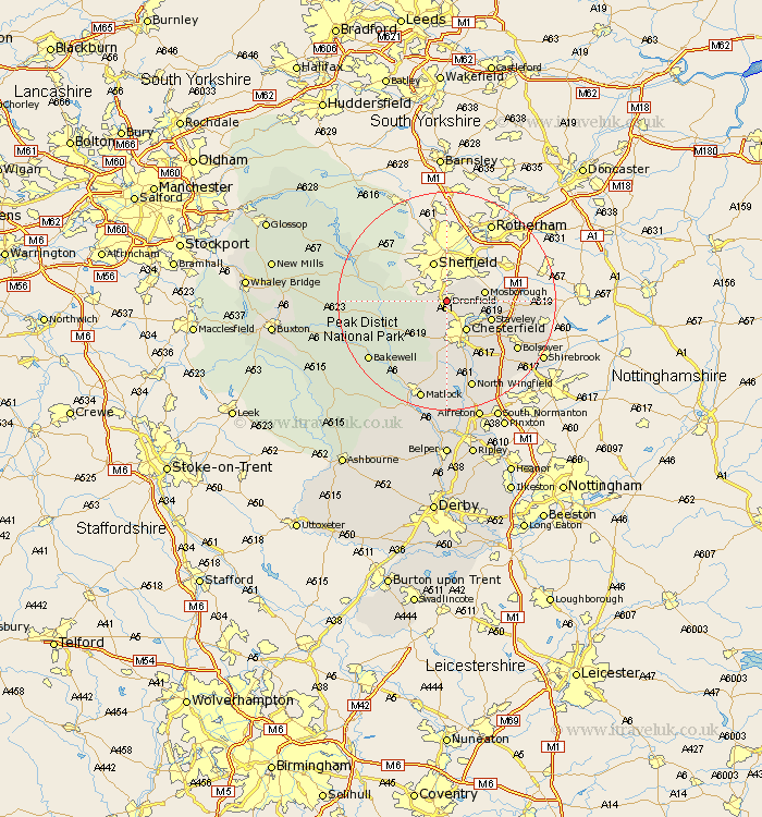
Derbyshire Map Showing Location of Dronfield
Population: 22468
Area Size (ha): 574
District: North East Derbyshire
Easting: 435539 Northing: 378279
Latitude: 53.3 Longitude: -1.47
 = Dronfield
Area Size (ha): 574
District: North East Derbyshire
Easting: 435539 Northing: 378279
Latitude: 53.3 Longitude: -1.47
= Dronfield
This Dronfield map below is supplied by Google. Use the tools in the top left corner to zoom into street level or zoom out for a road map, you may also need to zoom in to see Dronfield on the map. Click and drag the map to move around. If the map fails to load try and refresh your browser or zoom in or out (+ or -).
Update - it seems Google no longer allow people to use their maps for free! This Dronfield map sometimes loads and sometimes gives a error. I am working on a solution.
Closest 30 Towns or Cities to Dronfield (Population over 500)
Unstone 2.89km Holmesfield 3.81km Barlow 3.86km Chesterfield 6.48km Eckington 6.65km Mosborough 6.9km Mosbrough 6.9km Brimington 7.11km Brampton 7.74km Old Brampton 7.74km Staveley 8.6km Walton 9.27km Killamarsh 10.14km Grindleford Bridge 11.23km Grindleford 11.23km Wingerworth 11.34km Hathersage 12.32km Barlborough 12.33km Baslow 12.43km Stony Middleton 12.74km Stoney Middleton 12.74km Eyam 13.42km Heath 14.22km Ashover 14.86km Clowne 14.87km Bolsover 15.31km Bamford 15.43km Elmton 15.44km Whitwell 16.72km North Wingfield 16.87km