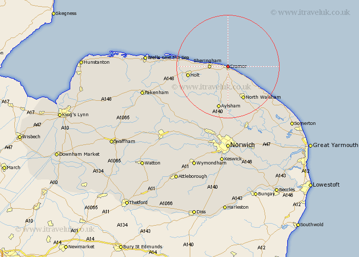
Norfolk Map Showing Location of Cromer
Population: 7417
Area Size (ha): 286
District: North Norfolk
Easting: 621750 Northing: 342455
Latitude: 52.93 Longitude: 1.3
 = Cromer
Area Size (ha): 286
District: North Norfolk
Easting: 621750 Northing: 342455
Latitude: 52.93 Longitude: 1.3
= Cromer
This Cromer map below is supplied by Google. Use the tools in the top left corner to zoom into street level or zoom out for a road map, you may also need to zoom in to see Cromer on the map. Click and drag the map to move around. If the map fails to load try and refresh your browser or zoom in or out (+ or -).
Update - it seems Google no longer allow people to use their maps for free! This Cromer map sometimes loads and sometimes gives a error. I am working on a solution.
Closest 30 Towns or Cities to Cromer (Population over 500)
Runton 3.35km West Runton 3.35km Overstrand 3.83km Northrepps 4.33km Roughton 5.56km Sheringham 6.7km Weybourne 10.05km Mundesley 10.77km Mundersley 10.77km Trunch 11.44km Erpingham 11.62km North Walsham 14.12km Bacton 14.52km Felmingham 14.99km Holt 14.99km Aylsham 17.01km Corpusty 17.12km Walcott 17.43km Briston 18.19km Marsham 18.83km Worstead 18.93km Melton Constable 20.15km Mellon Constable 20.15km Blakeney 20.44km Hevingham 20.51km Little Hautbois 20.51km Lamas Little Hautbois 20.51km Lammas 20.51km Cawston 20.58km Smallburgh 21.09km