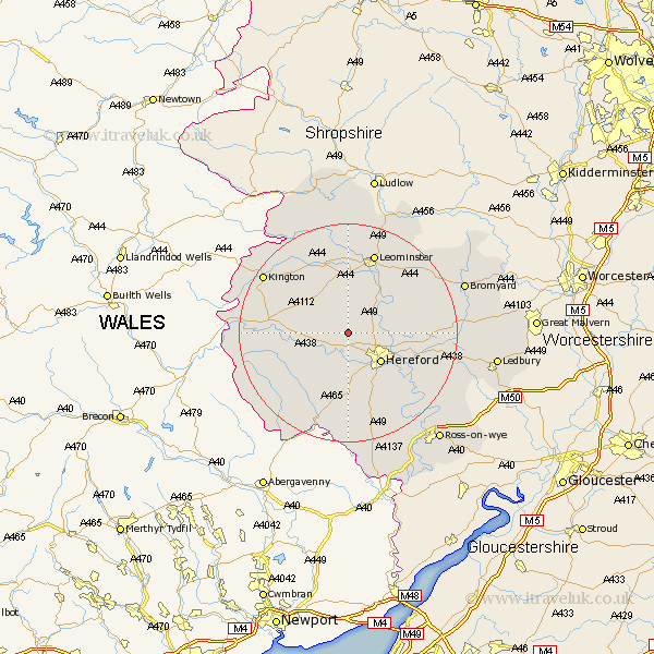
Herefordshire Map Showing Location of Credenhill
Population: 2198
Area Size (ha): 90
Easting: 345207 Northing: 244976
Latitude: 52.1 Longitude: -2.8
 = Credenhill
Area Size (ha): 90
Easting: 345207 Northing: 244976
Latitude: 52.1 Longitude: -2.8
= Credenhill
This Credenhill map below is supplied by Google. Use the tools in the top left corner to zoom into street level or zoom out for a road map, you may also need to zoom in to see Credenhill on the map. Click and drag the map to move around. If the map fails to load try and refresh your browser or zoom in or out (+ or -).
Update - it seems Google no longer allow people to use their maps for free! This Credenhill map sometimes loads and sometimes gives a error. I am working on a solution.
Closest 30 Towns or Cities to Credenhill (Population over 500)
Burghill 2.28km Moreton 4.55km Moreton on Lugg 4.55km Moreton-on-Lugg 4.55km Wellington 5.04km Hereford 7.96km Sutton 7.97km Madley 8.17km Weobley 8.7km Allensmore 9.33km Bullingham 9.35km Kingstone 9.54km Bodenham 9.71km Dilwyn 10.32km Lugwardine 10.9km Withington 11.38km Peterchurch 12.65km Mordiford 12.68km Eardisland 13.42km Much Dewchurch 13.42km Almeley 13.69km Eardisley 14.15km Pembridge 14.66km Leominster 15.5km Much Birch 15.88km Kingsland 16.68km Lyonshall 16.74km Shobdon 17.29km Fownhope 17.63km Ewyas Harold 17.63km