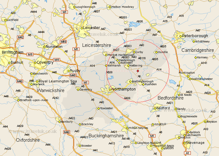
Northamptonshire Map Showing Location of Cranford
Population: 414
District: Kettering
Easting: 493042 Northing: 275215
Latitude: 52.37 Longitude: -0.63
 = Cranford
District: Kettering
Easting: 493042 Northing: 275215
Latitude: 52.37 Longitude: -0.63
= Cranford
This Cranford map below is supplied by Google. Use the tools in the top left corner to zoom into street level or zoom out for a road map, you may also need to zoom in to see Cranford on the map. Click and drag the map to move around. If the map fails to load try and refresh your browser or zoom in or out (+ or -).
Update - it seems Google no longer allow people to use their maps for free! This Cranford map sometimes loads and sometimes gives a error. I am working on a solution.
Closest 30 Towns or Cities to Cranford (Population over 500)
Burton Latimer 2.93km Finedon 3.71km Woodford 4.53km Isham 4.89km Ringstead 5.96km Irthlingborough 6km Kettering 6.76km Islip 7.03km Thrapston 7.73km Raunds 7.74km Stanwick 7.94km Geddington 8.15km Higham Ferrers 8.16km Wellingborough 8.69km Broughton 9.05km Brigstock 9.54km Rushden 9.88km Titchmarsh 10.83km Irchester 11.12km Stanion 11.18km Doddington 12.01km Great Doddington 12.01km Wilby 12.48km Rowell 12.6km Rothwell 12.6km Weldon 12.97km Walgrave 12.99km Corby 13.16km Wollaston 13.17km Sywell 13.78km