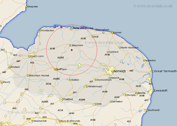
Norfolk Map Showing Location of Colkirk
Population: 547
District: Breckland
Easting: 592107 Northing: 326337
Latitude: 52.8 Longitude: 0.85
 = Colkirk
District: Breckland
Easting: 592107 Northing: 326337
Latitude: 52.8 Longitude: 0.85
= Colkirk
This Colkirk map below is supplied by Google. Use the tools in the top left corner to zoom into street level or zoom out for a road map, you may also need to zoom in to see Colkirk on the map. Click and drag the map to move around. If the map fails to load try and refresh your browser or zoom in or out (+ or -).
Update - it seems Google no longer allow people to use their maps for free! This Colkirk map sometimes loads and sometimes gives a error. I am working on a solution.
Closest 30 Towns or Cities to Colkirk (Population over 500)
Fakenham 3.87km Ryburgh 4.85km Great Ryburgh 4.85km Sculthorpe 5.99km Little Snoring 6.5km Mileham 7.42km Tatterset 8.67km Tattersett 8.67km East Rudham 9.15km Walsingham 9.53km Little Walsingham 9.53km Litcham 9.85km North Elmham 10.01km Beetley 10.29km Syderstone 10.54km South Creake 10.82km Hindolveston 11.36km Foulham 11.36km Foulsham 11.36km Great Massingham 12.87km Massingham 12.87km Melton Constable 13.51km Mellon Constable 13.51km Dereham 14.14km East Dereham 14.14km Bawdeswell 14.39km Briston 15.58km Bircham 15.58km Great Bircham 15.58km Castle Acre 15.79km