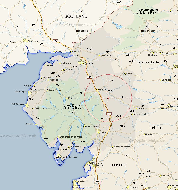
Cumbria Map Showing Location of Cliburn
Population: 204
District: Eden
Easting: 359089 Northing: 522955
Latitude: 54.6 Longitude: -2.63
 = Cliburn
District: Eden
Easting: 359089 Northing: 522955
Latitude: 54.6 Longitude: -2.63
= Cliburn
This Cliburn map below is supplied by Google. Use the tools in the top left corner to zoom into street level or zoom out for a road map, you may also need to zoom in to see Cliburn on the map. Click and drag the map to move around. If the map fails to load try and refresh your browser or zoom in or out (+ or -).
Update - it seems Google no longer allow people to use their maps for free! This Cliburn map sometimes loads and sometimes gives a error. I am working on a solution.
Closest 30 Towns or Cities to Cliburn (Population over 500)
Kirkby Thore 5.68km Culgaith 5.96km Long Marston 7.51km Long Marton 7.51km Langwathby 9.51km Shap 9.51km Crosby Ravensworth 9.81km Appleby 10.35km Dacre 13.01km Lasonby 15.43km Lazonby 15.43km Orton 15.44km Greystoke 16.02km Skelton 18.68km Kirkoswald 19.03km Tebay 20.64km Ainstable 23.15km Brough 23.4km Kirkby Stephen 23.53km Ravenstonedale 24.72km Staveley 28.52km Hesket Newmarket 28.77km Ambleside 29.64km Caldbeck 30.62km Koswick 31.13km Keswick 31.13km Windermere 31.75km Wetheral 31.91km Kendall 32.39km Kendal 32.39km