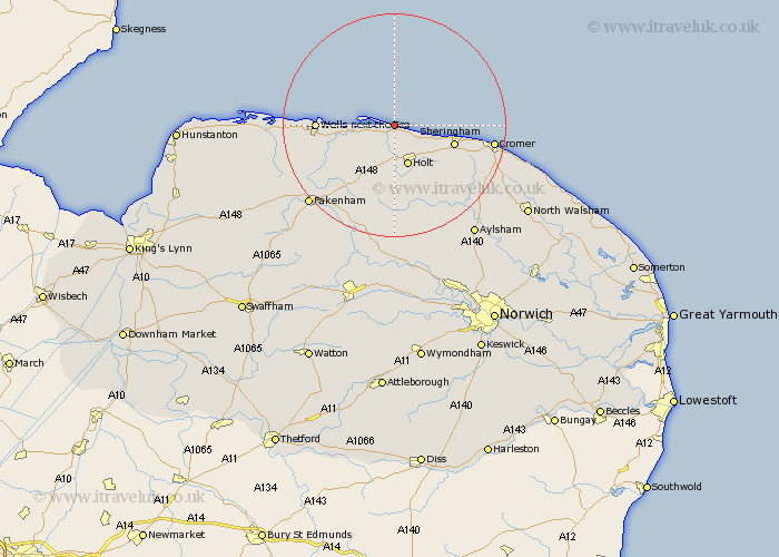
Norfolk Map Showing Location of Cley Next The Sea
Population: 376
District: North Norfolk
Easting: 604797 Northing: 345425
Latitude: 52.97 Longitude: 1.05
 = Cley Next The Sea
District: North Norfolk
Easting: 604797 Northing: 345425
Latitude: 52.97 Longitude: 1.05
= Cley Next The Sea
This Cley Next The Sea map below is supplied by Google. Use the tools in the top left corner to zoom into street level or zoom out for a road map, you may also need to zoom in to see Cley Next The Sea on the map. Click and drag the map to move around. If the map fails to load try and refresh your browser or zoom in or out (+ or -).
Update - it seems Google no longer allow people to use their maps for free! This Cley Next The Sea map sometimes loads and sometimes gives a error. I am working on a solution.
Closest 30 Towns or Cities to Cley Next The Sea (Population over 500)
Blakeney 3.35km Weybourne 7.66km Holt 7.75km Sheringham 10.71km Mellon Constable 13.02km Melton Constable 13.02km Briston 13.02km Wells on Sea 13.39km Wells 13.39km Wells-on-Sea 13.39km Wells next the Sea 13.39km Wells-next-the-Sea 13.39km Runton 13.9km West Runton 13.9km Walsingham 14.52km Little Walsingham 14.52km Little Snoring 16.42km Hindolveston 16.83km Cromer 17.16km Corpusty 17.59km Ryburgh 18.93km Great Ryburgh 18.93km Roughton 19.15km Erpingham 20km Sculthorpe 20.33km Northrepps 20.39km Foulsham 20.51km Foulham 20.51km Fakenham 20.77km Overstrand 20.86km