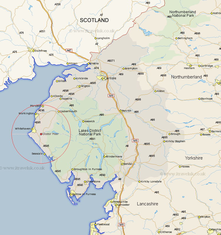
Cumbria Map Showing Location of Cleator Moor
Population: 6347
Area Size (ha): 124
District: Copeland
Easting: 301831 Northing: 514561
Latitude: 54.52 Longitude: -3.52
 = Cleator Moor
Area Size (ha): 124
District: Copeland
Easting: 301831 Northing: 514561
Latitude: 54.52 Longitude: -3.52
= Cleator Moor
This Cleator Moor map below is supplied by Google. Use the tools in the top left corner to zoom into street level or zoom out for a road map, you may also need to zoom in to see Cleator Moor on the map. Click and drag the map to move around. If the map fails to load try and refresh your browser or zoom in or out (+ or -).
Update - it seems Google no longer allow people to use their maps for free! This Cleator Moor map sometimes loads and sometimes gives a error. I am working on a solution.
Closest 30 Towns or Cities to Cleator Moor (Population over 500)
Frizington 2.84km Egremont 5.56km Whitehaven 6.53km St. Bega 6.72km St. Bees 6.72km St Bega 6.72km Saint Bega 6.72km St Bees 6.72km Saint Bees 6.72km Parton 7.03km Distington 7.48km Lowca 8.56km Lamplugh 9.36km Dean 10.71km Gosforth 14.05km Seascale 14.99km Workington 15.17km Brigham 16.16km Flimby 18.53km Broughton Moor 18.8km Cockermouth 19.84km Maryport 20.41km Bridekirk 20.89km Dearham 21.08km Crosscanonby 24.67km Koswick 27.4km Keswick 27.4km Aspatria 28.5km Bootle 29.45km Coniston 33.54km