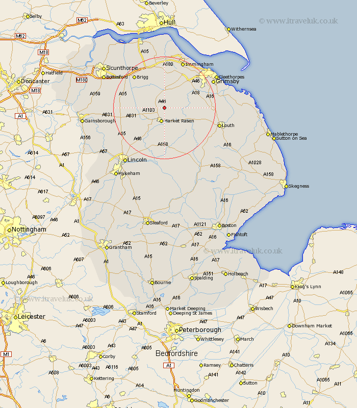
Lincolnshire Map Showing Location of Claxby
Population: 184
District: West Lindsey
Easting: 511819 Northing: 394294
Latitude: 53.43 Longitude: -0.32
 = Claxby
District: West Lindsey
Easting: 511819 Northing: 394294
Latitude: 53.43 Longitude: -0.32
= Claxby
This Claxby map below is supplied by Google. Use the tools in the top left corner to zoom into street level or zoom out for a road map, you may also need to zoom in to see Claxby on the map. Click and drag the map to move around. If the map fails to load try and refresh your browser or zoom in or out (+ or -).
Update - it seems Google no longer allow people to use their maps for free! This Claxby map sometimes loads and sometimes gives a error. I am working on a solution.
Closest 30 Towns or Cities to Claxby (Population over 500)
Caistor 5.56km Nettleton 5.56km Market Rasen 5.67km Middle Rasen 6.47km South Kelsey 8.57km North Kelsey 8.65km binbrook 8.83km Waddingham 13.38km Holton 14.86km Laceby 14.9km Keelby 15.48km Barnetby 15.82km Barnetby le Wold 15.82km South Killingholme 15.82km Hibaldstow 16.15km Wragby 16.72km Brigg 17.03km Waltham 17.08km Healing 17.85km Wrawby 17.85km Dunholm 17.85km Dunholme 17.85km North Thoresby 18.04km Scawby 18.14km Welton 18.49km Stallingborough 18.87km Scothern 18.88km Holton le Clay 18.97km Habrough 19.05km Kirton in Lindsey 19.13km