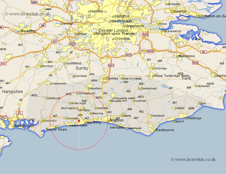
Sussex Map Showing Location of Clapham
Population: 317
District: Arun
Easting: 510312 Northing: 104983
Latitude: 50.83 Longitude: -0.43
 = Clapham
District: Arun
Easting: 510312 Northing: 104983
Latitude: 50.83 Longitude: -0.43
= Clapham
This Clapham map below is supplied by Google. Use the tools in the top left corner to zoom into street level or zoom out for a road map, you may also need to zoom in to see Clapham on the map. Click and drag the map to move around. If the map fails to load try and refresh your browser or zoom in or out (+ or -).
Update - it seems Google no longer allow people to use their maps for free! This Clapham map sometimes loads and sometimes gives a error. I am working on a solution.
Closest 30 Towns or Cities to Clapham (Population over 500)
Findon 2.99km Ferring 3.88km West Ferring 3.88km Angmering 3.97km Worthing 4.91km Kingston 5.68km Rustington 5.97km East Preston 6.03km Preston 6.03km Sompting 6.14km Lancing 7.26km North Lancing 7.26km Washington 7.78km Littlehampton 7.94km Arundel 8.4km Storrington 9.49km Upper Beeding 9.9km Bramber 9.9km Upper Bleeding 9.9km Steyning 9.9km Ashington 9.92km Ford 10.7km West Chiltington 11.18km West Chillington 11.18km Thakeham 11.18km Amberley 11.63km Bury 11.94km Yapton 12.28km Walberton 13.01km Coldwaltham 13.15km