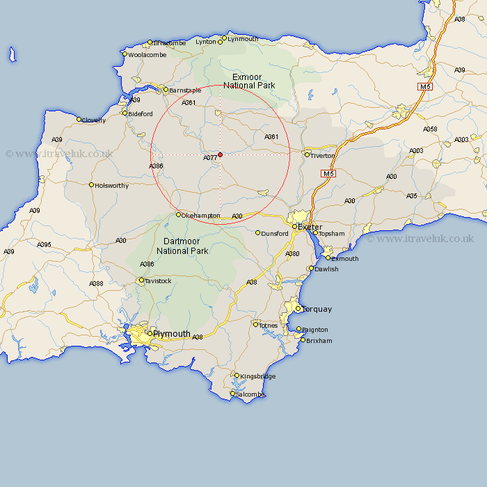
Devon Map Showing Location of Chawleigh
Population: 621
District: Mid Devon
Easting: 271096 Northing: 112831
Latitude: 50.9 Longitude: -3.83
 = Chawleigh
District: Mid Devon
Easting: 271096 Northing: 112831
Latitude: 50.9 Longitude: -3.83
= Chawleigh
This Chawleigh map below is supplied by Google. Use the tools in the top left corner to zoom into street level or zoom out for a road map, you may also need to zoom in to see Chawleigh on the map. Click and drag the map to move around. If the map fails to load try and refresh your browser or zoom in or out (+ or -).
Update - it seems Google no longer allow people to use their maps for free! This Chawleigh map sometimes loads and sometimes gives a error. I am working on a solution.
Closest 30 Towns or Cities to Chawleigh (Population over 500)
Chulmleigh 2.98km Lapford 4.38km Morchard Bishop 8.07km Witheridge 8.39km Burrington 8.98km Barrington 8.98km Bow 11.18km Nymet Tracey 11.18km North Tawton 12.06km Copplestone 12.56km South Molton 12.98km High Bickington 13.84km Dolton 14.15km Sandford 14.92km Chittlehampton 15.33km Sampford Courtenay 15.35km Sampford Courtnay 15.35km Sampford Courtney 15.35km Cheriton Fitzpaine 16.19km North Molton 16.84km Crediton 18.28km Hatherleigh 18.82km Swimbridge 19.11km South Tawton 19.12km Cheriton Bishop 19.82km Tedburn Saint Mary 21.32km Tedburn St Mary 21.32km Tedburn St. Mary 21.32km Okehampton 21.92km Saint Cyres 22.1km