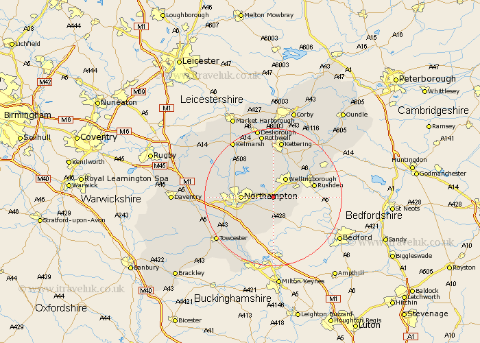
Northamptonshire Map Showing Location of Earls Barton
Population: 4810
Area Size (ha): 133
District: Wellingborough
Easting: 485324 Northing: 262093
Latitude: 52.25 Longitude: -0.75
 = Earls Barton
Area Size (ha): 133
District: Wellingborough
Easting: 485324 Northing: 262093
Latitude: 52.25 Longitude: -0.75
= Earls Barton
This Earls Barton map below is supplied by Google. Use the tools in the top left corner to zoom into street level or zoom out for a road map, you may also need to zoom in to see Earls Barton on the map. Click and drag the map to move around. If the map fails to load try and refresh your browser or zoom in or out (+ or -).
Update - it seems Google no longer allow people to use their maps for free! This Earls Barton map sometimes loads and sometimes gives a error. I am working on a solution.
Closest 30 Towns or Cities to Earls Barton (Population over 500)
Whiston 1.86km Wilby 2.93km Doddington 3.88km Great Doddington 3.88km Sywell 4.34km Great Billing 4.54km Billing 4.54km Wollaston 5.67km Denton 5.67km Yardley Hastings 5.67km Overstone 5.86km Wellingborough 6.52km Bozeat 6.78km Great Houghton 6.78km Houghton 6.78km Moulton 7.75km Irchester 8.15km Hackleton 8.7km Northampton 9.08km Walgrave 10.32km Pitsford 10.64km Hardingstone 10.65km Boughton 10.86km Isham 11.63km Wootton 11.73km Rushden 11.93km Finedon 12.2km Burton Latimer 12.48km Brixworth 12.61km Irthlingborough 12.61km