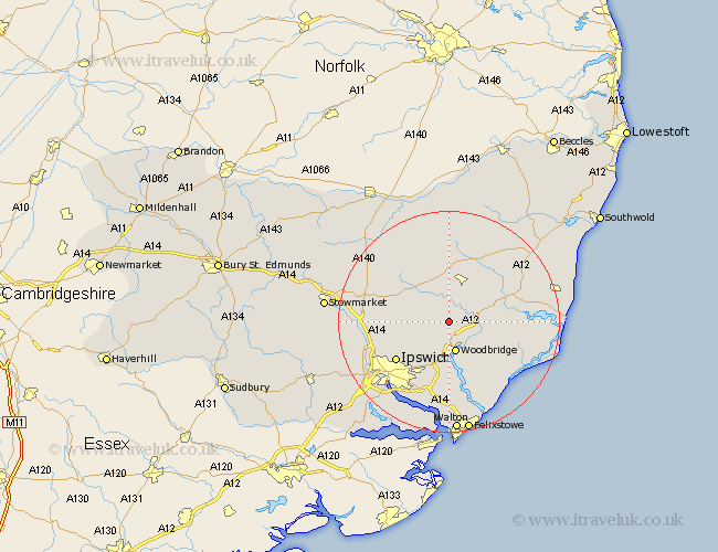
Suffolk Map Showing Location of Charsfield
Population: 358
District: Suffolk Coastal
Easting: 625736 Northing: 255371
Latitude: 52.15 Longitude: 1.3
 = Charsfield
District: Suffolk Coastal
Easting: 625736 Northing: 255371
Latitude: 52.15 Longitude: 1.3
= Charsfield
This Charsfield map below is supplied by Google. Use the tools in the top left corner to zoom into street level or zoom out for a road map, you may also need to zoom in to see Charsfield on the map. Click and drag the map to move around. If the map fails to load try and refresh your browser or zoom in or out (+ or -).
Update - it seems Google no longer allow people to use their maps for free! This Charsfield map sometimes loads and sometimes gives a error. I am working on a solution.
Closest 30 Towns or Cities to Charsfield (Population over 500)
Wickham Market 4.55km Otley 4.55km Ufford 5.04km Melton 5.67km Woodbridge 5.67km Grundisburgh 6.52km Martlesham 7.42km Framlingham 7.76km Rendlesham 8.78km Martlesham Heath 9.33km Wirnesham 9.71km Witnesham 9.71km Sutton 9.87km Tunstall 10.4km Debenham 10.88km Henley 10.89km Ipswich 11.74km Coddenham 12.65km Dennington 12.98km Worlingworth 13.42km Bucklesham 13.42km Snape 14.13km Hollesley 14.37km Claydon 14.55km Great Blakenham 14.74km Nacton 15.51km Saxmundham 15.52km Bramford 16.5km Kirton 16.72km Kirkton 16.72km