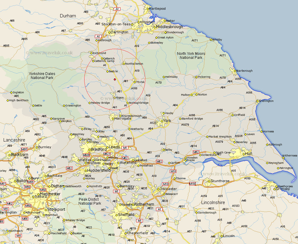
Yorkshire Map Showing Location of Carthorpe
Population: 240
District: Hambleton
Easting: 431501 Northing: 482080
Latitude: 54.23 Longitude: -1.52
 = Carthorpe
District: Hambleton
Easting: 431501 Northing: 482080
Latitude: 54.23 Longitude: -1.52
= Carthorpe
This Carthorpe map below is supplied by Google. Use the tools in the top left corner to zoom into street level or zoom out for a road map, you may also need to zoom in to see Carthorpe on the map. Click and drag the map to move around. If the map fails to load try and refresh your browser or zoom in or out (+ or -).
Update - it seems Google no longer allow people to use their maps for free! This Carthorpe map sometimes loads and sometimes gives a error. I am working on a solution.
Closest 30 Towns or Cities to Carthorpe (Population over 500)
Tanfield 4.93km West Tanfield 4.93km Bedale 7.05km Masham 8.86km Crakehall 9.86km Grewelthorpe 10.3km Topcliffe 10.3km Dishforth 11.32km Kirkby Malzeard 11.4km Thirsk 12.06km Northallerton 12.37km Ripon 12.97km Brompton 14.51km Catterick 16.65km Bishop Monkton 16.71km Monkton 16.71km Scorton 17.53km Boroughbridge 18.33km Burton Leonard 18.56km North Cowton 18.66km Middleham 20.26km East Cowton 20.42km Cowton 20.42km Osmotherley 20.44km Raskelf 20.61km Leyburn 20.85km Marton 20.94km Marton le Moor 20.94km Birstwith 23.17km Richmond 23.26km