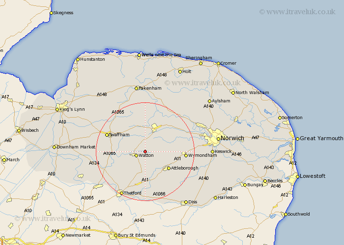
Norfolk Map Showing Location of Carbooke
Population: 1176
District: Breckland
Easting: 595319 Northing: 302332
Latitude: 52.58 Longitude: 0.88
 = Carbooke
District: Breckland
Easting: 595319 Northing: 302332
Latitude: 52.58 Longitude: 0.88
= Carbooke
This Carbooke map below is supplied by Google. Use the tools in the top left corner to zoom into street level or zoom out for a road map, you may also need to zoom in to see Carbooke on the map. Click and drag the map to move around. If the map fails to load try and refresh your browser or zoom in or out (+ or -).
Update - it seems Google no longer allow people to use their maps for free! This Carbooke map sometimes loads and sometimes gives a error. I am working on a solution.
Closest 30 Towns or Cities to Carbooke (Population over 500)
Watton 3.85km Griston 3.87km Shipdham 3.88km Ashill 5.93km Rockland Saint Peter 6km Rockland 6km Rockland St Peter 6km Rockland St. Peter 6km Hingham 6.76km Great Ellingham 7.91km Hockham 9.26km Yaxham 9.31km Necton 10.03km East Dereham 11.62km Dereham 11.62km Attleborough 11.67km Mattishall 12.55km Besthorpe 12.56km Palgrave 13.73km Great Palgrave 13.73km Beetley 15km Hockering 15.46km Old Buckenham 15.83km Litcham 15.86km Wymondham 15.88km Quidenham 16.29km Swaffham 16.4km Mileham 16.83km East Harling 17.02km North Elmham 17.27km