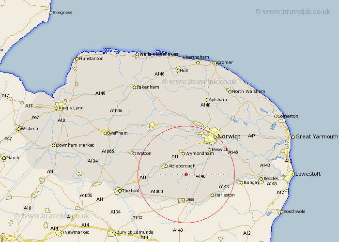
Norfolk Map Showing Location of Bunwell
Population: 885
District: South Norfolk
Easting: 612732 Northing: 291921
Latitude: 52.48 Longitude: 1.13
 = Bunwell
District: South Norfolk
Easting: 612732 Northing: 291921
Latitude: 52.48 Longitude: 1.13
= Bunwell
This Bunwell map below is supplied by Google. Use the tools in the top left corner to zoom into street level or zoom out for a road map, you may also need to zoom in to see Bunwell on the map. Click and drag the map to move around. If the map fails to load try and refresh your browser or zoom in or out (+ or -).
Update - it seems Google no longer allow people to use their maps for free! This Bunwell map sometimes loads and sometimes gives a error. I am working on a solution.
Closest 30 Towns or Cities to Bunwell (Population over 500)
Moulton 3.86km Moulton St Michael 3.86km Moulton St. Michael 3.86km Great Moulton 3.86km Moulton Saint Michael 3.86km Forncett Saint Mary 4.88km Forncett St Mary 4.88km Forncett St. Mary 4.88km Forncett 4.88km Old Buckenham 5.64km Ashwellthorpe 6.51km Long Stratton 6.77km Besthorpe 7.72km Banham 7.72km Attleborough 8.73km Burston 9.33km Wymondham 9.34km Mulbarton 10.04km Saxlingham 10.6km Saxlingham Thorpe 10.6km Quidenham 10.81km Pulham 10.83km Diss 11.18km Hempnall 11.44km Kenninghall 11.58km Swardeston 12.18km Great Ellingham 12.58km North Lopham 12.94km Bressingham 13.02km Scole 13.16km