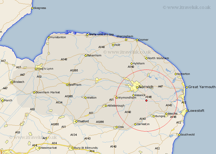
Norfolk Map Showing Location of Brooke
Population: 1242
District: South Norfolk
Easting: 629353 Northing: 300102
Latitude: 52.55 Longitude: 1.38
 = Brooke
District: South Norfolk
Easting: 629353 Northing: 300102
Latitude: 52.55 Longitude: 1.38
= Brooke
This Brooke map below is supplied by Google. Use the tools in the top left corner to zoom into street level or zoom out for a road map, you may also need to zoom in to see Brooke on the map. Click and drag the map to move around. If the map fails to load try and refresh your browser or zoom in or out (+ or -).
Update - it seems Google no longer allow people to use their maps for free! This Brooke map sometimes loads and sometimes gives a error. I am working on a solution.
Closest 30 Towns or Cities to Brooke (Population over 500)
Poringland 2.25km Thurton 3.38km Stoke Holy Cross 5.63km Loddon 6.75km Hempnall 7.92km Saxlingham Thorpe 8.1km Saxlingham 8.1km Chedgrave 8.11km Brundall 8.15km Blofield 8.68km Cantley 9.2km Swardeston 9.2km Thorpe Episcopi 9.53km Thorpe St Andrew 9.53km Thorpe 9.53km Thorpe Saint Andrew 9.53km Thorpe next Norwich 9.53km Thorpe St. Andrew 9.53km Ditchingham 9.86km Lingwood 10.03km Mulbarton 10.14km Cringleford 10.59km Norwich 10.84km Great Plumstead 11.18km Earsham 11.35km Ellingham 11.47km Freethorpe 11.86km Reedham 12.4km Thurlton 12.54km Long Stratton 12.57km