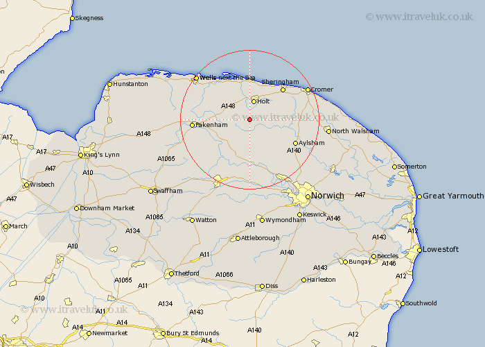
Norfolk Map Showing Location of Briston
Population: 2134
Area Size (ha): 100
District: North Norfolk
Easting: 606471 Northing: 332497
Latitude: 52.85 Longitude: 1.07
 = Briston
Area Size (ha): 100
District: North Norfolk
Easting: 606471 Northing: 332497
Latitude: 52.85 Longitude: 1.07
= Briston
This Briston map below is supplied by Google. Use the tools in the top left corner to zoom into street level or zoom out for a road map, you may also need to zoom in to see Briston on the map. Click and drag the map to move around. If the map fails to load try and refresh your browser or zoom in or out (+ or -).
Update - it seems Google no longer allow people to use their maps for free! This Briston map sometimes loads and sometimes gives a error. I am working on a solution.
Closest 30 Towns or Cities to Briston (Population over 500)
Briston 0km Mellon Constable 2.24km Melton Constable 2.24km Hindolveston 5km Holt 5.67km Corpusty 5.81km Foulham 8.14km Foulsham 8.14km Ryburgh 10.74km Great Ryburgh 10.74km Weybourne 10.82km Little Snoring 11.19km Cawston 11.44km Reepham 11.62km Erpingham 12.45km Little Walsingham 12.85km Walsingham 12.85km Sheringham 12.88km Bawdeswell 13.17km Witchingham 13.4km Blakeney 13.72km Aylsham 14.38km Lyng 14.82km North Elmham 15.16km West Runton 15.4km Runton 15.4km Marsham 15.42km Colkirk 15.58km Fakenham 15.78km Roughton 16.09km