Herefordshire Map Showing Location of Brimfield
Population: 704
Easting: 352271 Northing: 267149
Latitude: 52.3 Longitude: -2.7
 = Brimfield
Easting: 352271 Northing: 267149
Latitude: 52.3 Longitude: -2.7
= Brimfield
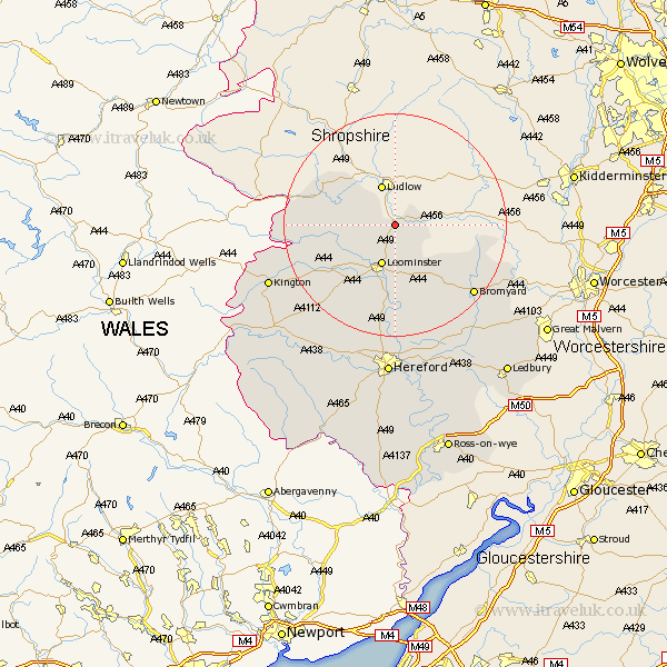
This Brimfield map below is supplied by Google. Use the tools in the top left corner to zoom into street level or zoom out for a road map, you may also need to zoom in to see Brimfield on the map. Click and drag the map to move around. If the map fails to load try and refresh your browser or zoom in or out (+ or -).
Update - it seems Google no longer allow people to use their maps for free! This Brimfield map sometimes loads and sometimes gives a error. I am working on a solution.
Closest 30 Towns or Cities to Brimfield (Population over 500)
Orleton 3.4km Luston 5.03km Croft 7.05km Leominster 7.76km Kingsland 8.79km Wigmore 10.37km Shobdon 12.63km Leintwardine 13.54km Eardisland 13.79km Pembridge 16.47km Bodenham 16.72km Dilwyn 17.24km Weobley 18.67km Bromyard 18.81km Wellington 18.85km Lyonshall 22.26km Sutton 22.27km Moreton-on-Lugg 22.36km Moreton on Lugg 22.36km Moreton 22.36km Whitbourne 22.42km Withington 22.7km Burghill 22.7km Credenhill 23.26km Kington 24.26km Almeley 25.51km Lugwardine 26.16km Eardisley 27.59km Hereford 27.82km Mordiford 28.17km