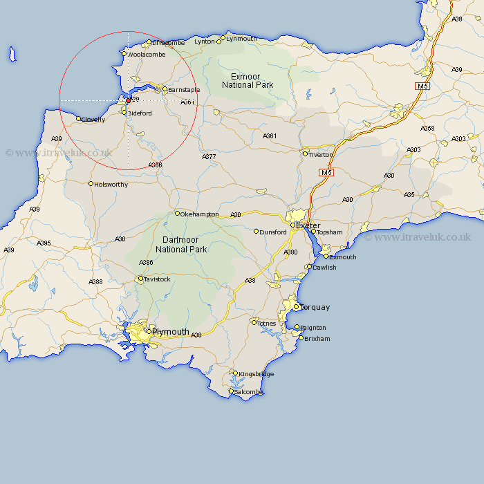
Devon Map Showing Location of Appledore
Population: 2265
Area Size (ha): 53
District: Torridge
Easting: 245815 Northing: 130212
Latitude: 51.05 Longitude: -4.2
 = Appledore
Area Size (ha): 53
District: Torridge
Easting: 245815 Northing: 130212
Latitude: 51.05 Longitude: -4.2
= Appledore
This Appledore map below is supplied by Google. Use the tools in the top left corner to zoom into street level or zoom out for a road map, you may also need to zoom in to see Appledore on the map. Click and drag the map to move around. If the map fails to load try and refresh your browser or zoom in or out (+ or -).
Update - it seems Google no longer allow people to use their maps for free! This Appledore map sometimes loads and sometimes gives a error. I am working on a solution.
Closest 30 Towns or Cities to Appledore (Population over 500)
Northam 2.19km Instow 2.33km Bideford 3.89km Braunton 5.68km Fremington 6.11km Georgeham 9.26km Buckland Brewer 9.9km Tawstock 10.49km Marwood 11.02km Barnstaple 11.12km Parkham 11.61km Torrington 11.66km Great Torrington 11.66km West Down 14.22km Langtree 14.82km Morthoe 14.82km Mortehoe 14.82km Woolfardisworthy 15.82km Woolsery 15.82km Swimbridge 16.31km High Bickington 16.78km Chittlehampton 17.87km Bratton Fleming 18.97km Berrynarbor 19.1km Ilfracombe 19.42km Iltracombe 19.42km Combe Martin 20.33km Hartland 20.58km Bradworthy 21.05km Burrington 21.78km