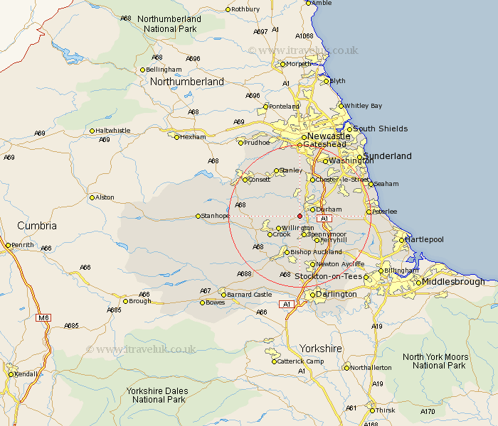
Durham Map Showing Location of Brandon
Population: 9091
Area Size (ha): 271
District: Durham
Easting: 424670 Northing: 539528
Latitude: 54.75 Longitude: -1.62
 = Brandon
Area Size (ha): 271
District: Durham
Easting: 424670 Northing: 539528
Latitude: 54.75 Longitude: -1.62
= Brandon
This Brandon map below is supplied by Google. Use the tools in the top left corner to zoom into street level or zoom out for a road map, you may also need to zoom in to see Brandon on the map. Click and drag the map to move around. If the map fails to load try and refresh your browser or zoom in or out (+ or -).
Update - it seems Google no longer allow people to use their maps for free! This Brandon map sometimes loads and sometimes gives a error. I am working on a solution.
Closest 30 Towns or Cities to Brandon (Population over 500)
Durham 3.71km Ushaw Moor 4.28km Witton Gilbert 5.66km Shincliffe 5.66km Spennymoor 5.74km Langley Park 6.42km Esh 6.5km Willington 6.51km Bowburn 6.68km Sacriston 7.42km Coxhoe 8.36km West Cornforth 8.49km Cornforth 8.49km Ferryhill 8.56km Sherburn 8.75km Crook 9.33km Coundon 9.51km Pittington 10.2km Cornsay 10.31km Lanchester 10.53km West Rainton 10.53km Edmondsley 11.17km Bishop Middleham 11.33km Chester-le-Street 11.57km Bishop Auckland 11.57km Thornley 11.77km Tow Law 12.97km Hetton le Hole 13.01km Pelton 13.02km Shildon 13.15km