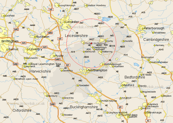
Northamptonshire Map Showing Location of Brampton Ash
Population: 59
District: Kettering
Easting: 479247 Northing: 286098
Latitude: 52.47 Longitude: -0.83
 = Brampton Ash
District: Kettering
Easting: 479247 Northing: 286098
Latitude: 52.47 Longitude: -0.83
= Brampton Ash
This Brampton Ash map below is supplied by Google. Use the tools in the top left corner to zoom into street level or zoom out for a road map, you may also need to zoom in to see Brampton Ash on the map. Click and drag the map to move around. If the map fails to load try and refresh your browser or zoom in or out (+ or -).
Update - it seems Google no longer allow people to use their maps for free! This Brampton Ash map sometimes loads and sometimes gives a error. I am working on a solution.
Closest 30 Towns or Cities to Brampton Ash (Population over 500)
Wilbarston 2.92km Desborough 3.88km Cottingham 5.94km Rowell 6km Rothwell 6km Caldecott 9.66km Clipston 9.67km Geddington 10.82km Kettering 10.84km Corby 11.44km Broughton 12km Stanion 12.42km Gretton 13.5km Weldon 13.67km Naseby 13.76km Walgrave 14.87km Welford 15.7km Isham 15.82km Brigstock 15.92km Burton Latimer 17.21km Brixworth 17.28km Spratton 18.46km Guilsborough 18.65km Pitsford 18.84km Finedon 20.1km Overstone 20.42km Moulton 20.42km Wellingborough 20.63km Sywell 20.67km Boughton 20.89km