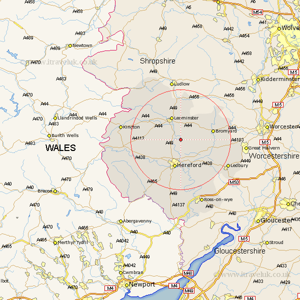
Herefordshire Map Showing Location of Bodenham
Population: 1024
Easting: 353250 Northing: 250456
Latitude: 52.15 Longitude: -2.68
 = Bodenham
Easting: 353250 Northing: 250456
Latitude: 52.15 Longitude: -2.68
= Bodenham
This Bodenham map below is supplied by Google. Use the tools in the top left corner to zoom into street level or zoom out for a road map, you may also need to zoom in to see Bodenham on the map. Click and drag the map to move around. If the map fails to load try and refresh your browser or zoom in or out (+ or -).
Update - it seems Google no longer allow people to use their maps for free! This Bodenham map sometimes loads and sometimes gives a error. I am working on a solution.
Closest 30 Towns or Cities to Bodenham (Population over 500)
Bodenham 0km Wellington 4.91km Sutton 5.56km Withington 6.52km Moreton 6.52km Moreton on Lugg 6.52km Moreton-on-Lugg 6.52km Burghill 7.95km Lugwardine 9.54km Credenhill 9.71km Leominster 9.87km Hereford 11.35km Mordiford 11.63km Weobley 12.64km Dilwyn 13.04km Bromyard 13.04km Bullingham 13.18km Eardisland 13.57km Kingsland 13.67km Luston 13.75km Allensmore 16.32km Pembridge 16.53km Brimfield 16.72km Shobdon 16.73km Croft 16.82km Madley 17.26km Orleton 17.29km Bosbury 17.57km Fownhope 17.63km Kingstone 18.02km