Worcestershire Map Showing Location of Bockleton
Population: 190
District: Malvern Hills
Easting: 359043 Northing: 261527
Latitude: 52.25 Longitude: -2.6
 = Bockleton
District: Malvern Hills
Easting: 359043 Northing: 261527
Latitude: 52.25 Longitude: -2.6
= Bockleton
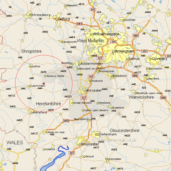
This Bockleton map below is supplied by Google. Use the tools in the top left corner to zoom into street level or zoom out for a road map, you may also need to zoom in to see Bockleton on the map. Click and drag the map to move around. If the map fails to load try and refresh your browser or zoom in or out (+ or -).
Update - it seems Google no longer allow people to use their maps for free! This Bockleton map sometimes loads and sometimes gives a error. I am working on a solution.
Closest 30 Towns or Cities to Bockleton (Population over 500)
Tenbury Wells 5.67km Tenbury 5.67km Lindridge 11.72km Clifton 12.48km Clifton upon Teme 12.48km Suckley 15.55km Martley 16km Rock 16.46km Abberley 16.82km Great Witley 17.41km Astley 20.06km Leigh 20.68km Holt 23.83km Grimley 23.9km Hallow 24.12km Bewdley 24.3km Malvern 24.35km Great Malvern 24.35km Ombersley 25.03km Stourport on Severn 25.25km Stourport-on-Severn 25.25km Stourport 25.25km Powick 25.58km Malvern Wells 25.97km Upper Arley 26.53km Arley 26.53km Hartlebury 26.6km Fernhill Heath 27.3km Worcester 27.81km Kidderminster 28.03km