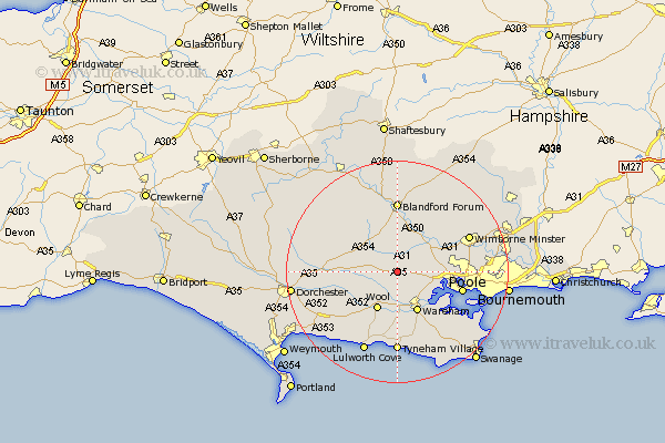
Dorset Map Showing Location of Bloxworth
Population: 187
District: Purbeck
Easting: 388243 Northing: 94565
Latitude: 50.75 Longitude: -2.17
 = Bloxworth
District: Purbeck
Easting: 388243 Northing: 94565
Latitude: 50.75 Longitude: -2.17
= Bloxworth
This Bloxworth map below is supplied by Google. Use the tools in the top left corner to zoom into street level or zoom out for a road map, you may also need to zoom in to see Bloxworth on the map. Click and drag the map to move around. If the map fails to load try and refresh your browser or zoom in or out (+ or -).
Update - it seems Google no longer allow people to use their maps for free! This Bloxworth map sometimes loads and sometimes gives a error. I am working on a solution.
Closest 30 Towns or Cities to Bloxworth (Population over 500)
Winterborne Kingston 2.99km Bere Regis 3.52km Holton Heath 6.94km Holton Heath Station 6.94km Lytchett Matravers 7.04km Whitechurch 7.27km Wool 7.87km Sturminster Marshall 7.95km Bovington Camp 8.08km Spetisbury 8.21km Wareham 8.21km Milborne St. Andrew 8.41km Milborne 8.41km Milborne Saint Andrew 8.41km Milborne St Andrew 8.41km Milton Abbas 9.91km Corfe Mullen 10.08km Stickland Winterborne 10.38km Winterborne Stickland 10.38km Arne 10.91km Poole 12.3km Puddletown 12.9km Piddletown 12.9km Blandford 12.98km Blandford Forum 12.98km Winfrith 13.16km Winfrith Newburgh 13.16km Tarrant Monkton 14.24km Wimborne 14.51km Wimborne Minster 14.51km