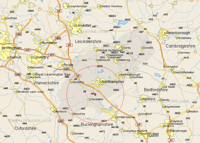
Northamptonshire Map Showing Location of Blisworth
Population: 1613
Area Size (ha): 38
District: South Northamptonshire
Easting: 472946 Northing: 252629
Latitude: 52.17 Longitude: -0.93
 = Blisworth
Area Size (ha): 38
District: South Northamptonshire
Easting: 472946 Northing: 252629
Latitude: 52.17 Longitude: -0.93
= Blisworth
This Blisworth map below is supplied by Google. Use the tools in the top left corner to zoom into street level or zoom out for a road map, you may also need to zoom in to see Blisworth on the map. Click and drag the map to move around. If the map fails to load try and refresh your browser or zoom in or out (+ or -).
Update - it seems Google no longer allow people to use their maps for free! This Blisworth map sometimes loads and sometimes gives a error. I am working on a solution.
Closest 30 Towns or Cities to Blisworth (Population over 500)
Blisworth 0km Milton 2.17km Gayton 2.27km Collingtree 2.93km Wootton 3.88km Roade 3.88km Hardingstone 5.03km Towcester 5.04km Pattishall 5.68km Kislingbury 6.01km Bugbrooke 6.78km Hartwell 6.79km Harpole 8.15km Hackleton 8.17km Great Houghton 8.8km Houghton 8.8km Paulerspury 9.27km Northampton 9.87km Whittlebury 9.88km Weedon Beck 10.65km Weedon 10.65km Flore 10.87km Silverstone 10.88km Potterspury 11.63km Denton 11.95km Billing 12.21km Great Billing 12.21km Boughton 13.16km Yardley Hastings 14.13km Moulton 14.15km