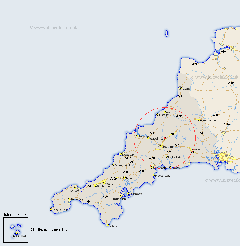
Cornwall Map Showing Location of Blisland
Population: 565
District: North Cornwall
Easting: 209793 Northing: 72050
Latitude: 50.52 Longitude: -4.68
 = Blisland
District: North Cornwall
Easting: 209793 Northing: 72050
Latitude: 50.52 Longitude: -4.68
= Blisland
This Blisland map below is supplied by Google. Use the tools in the top left corner to zoom into street level or zoom out for a road map, you may also need to zoom in to see Blisland on the map. Click and drag the map to move around. If the map fails to load try and refresh your browser or zoom in or out (+ or -).
Update - it seems Google no longer allow people to use their maps for free! This Blisland map sometimes loads and sometimes gives a error. I am working on a solution.
Closest 30 Towns or Cities to Blisland (Population over 500)
Blisland 0km Cardingham 4.4km Cardinham 4.4km Bodmin 6.04km Lanivet 9.47km Wadebridge 10.61km Camelford 11.12km Lostwithiel 13.03km Saint Blazey 13.19km St Blazey 13.19km St. Blazey 13.19km Dobwalls 13.93km Altarnun 14.07km Stenalees 16.56km St. Issey 16.6km St Issey 16.6km Saint Issey 16.6km Roche 16.77km Lanreath 16.98km Bugle 16.98km Tintagel 17.33km Padstow 17.77km North Hill 18.05km Liskeard 18.1km Tywardreath 18.54km Lansallos 18.61km Forrabury 18.67km Par 18.69km Pelynt 19.77km Lewannick 19.94km