Norfolk Map Showing Location of Blickling
Population: 136
District: Broadland
Easting: 614570 Northing: 327280
Latitude: 52.8 Longitude: 1.18
 = Blickling
District: Broadland
Easting: 614570 Northing: 327280
Latitude: 52.8 Longitude: 1.18
= Blickling
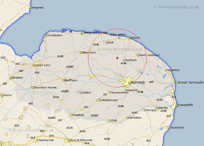
This Blickling map below is supplied by Google. Use the tools in the top left corner to zoom into street level or zoom out for a road map, you may also need to zoom in to see Blickling on the map. Click and drag the map to move around. If the map fails to load try and refresh your browser or zoom in or out (+ or -).
Update - it seems Google no longer allow people to use their maps for free! This Blickling map sometimes loads and sometimes gives a error. I am working on a solution.
Closest 30 Towns or Cities to Blickling (Population over 500)
Corpusty 3.84km Cawston 3.87km Aylsham 4.85km Erpingham 5.81km Marsham 5.82km Reepham 7.14km Hevingham 7.9km Witchingham 8.67km Briston 9.61km Felmingham 10.08km Hindolveston 11.36km Foulham 11.36km Foulsham 11.36km Melton Constable 11.51km Mellon Constable 11.51km Lammas 11.52km Lamas Little Hautbois 11.52km Little Hautbois 11.52km Roughton 12.13km Hainford 12.14km Haynford 12.14km Lyng 12.14km Bawdeswell 12.53km Holt 12.99km North Walsham 13.57km Horsford 13.73km Coltishall 14.39km Horstead 14.55km Horsham Saint Faith 14.62km Horsham St. Faith 14.62km