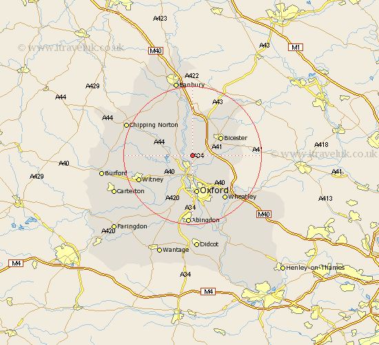
Oxfordshire Map Showing Location of Bletchingdon
Population: 872
District: Cherwell
Easting: 450506 Northing: 217126
Latitude: 51.85 Longitude: -1.27
 = Bletchingdon
District: Cherwell
Easting: 450506 Northing: 217126
Latitude: 51.85 Longitude: -1.27
= Bletchingdon
This Bletchingdon map below is supplied by Google. Use the tools in the top left corner to zoom into street level or zoom out for a road map, you may also need to zoom in to see Bletchingdon on the map. Click and drag the map to move around. If the map fails to load try and refresh your browser or zoom in or out (+ or -).
Update - it seems Google no longer allow people to use their maps for free! This Bletchingdon map sometimes loads and sometimes gives a error. I am working on a solution.
Closest 30 Towns or Cities to Bletchingdon (Population over 500)
Kirtlington 1.86km Woodstock 3.43km Kidlington 3.88km Tackley 3.9km Islip 4.35km Yarnton 6.01km Chesterton 6.82km Bladon 6.82km Steeple Aston 7.76km Upper Heyford 9.27km Cassington 9.37km Beckley 9.37km Bicester 9.75km Hanborough 9.76km Church Handborough 9.76km Ardley 9.88km Ambrosden 10.3km Duns Tew 10.33km Launton 10.94km Oxford 11.18km Fritwell 11.35km Caversfield 11.53km Stonesfield 11.6km Ensham 12.25km Eynsham 12.25km North Leigh 12.73km North Hinksey 13.03km Charlbury 13.86km Enstone 14.61km Fringford 15.15km