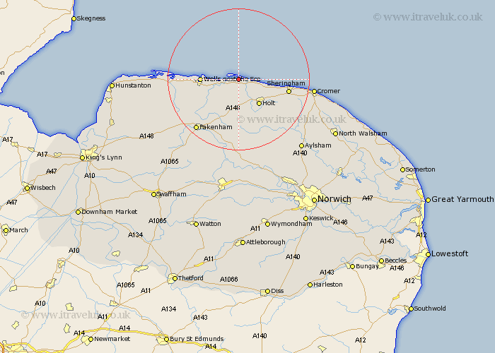
Norfolk Map Showing Location of Blakeney
Population: 789
District: North Norfolk
Easting: 601441 Northing: 345283
Latitude: 52.97 Longitude: 1
 = Blakeney
District: North Norfolk
Easting: 601441 Northing: 345283
Latitude: 52.97 Longitude: 1
= Blakeney
This Blakeney map below is supplied by Google. Use the tools in the top left corner to zoom into street level or zoom out for a road map, you may also need to zoom in to see Blakeney on the map. Click and drag the map to move around. If the map fails to load try and refresh your browser or zoom in or out (+ or -).
Update - it seems Google no longer allow people to use their maps for free! This Blakeney map sometimes loads and sometimes gives a error. I am working on a solution.
Closest 30 Towns or Cities to Blakeney (Population over 500)
Holt 9.28km Wells next the Sea 10.05km Wells on Sea 10.05km Wells 10.05km Wells-next-the-Sea 10.05km Wells-on-Sea 10.05km Weybourne 10.71km Walsingham 12.13km Little Walsingham 12.13km Mellon Constable 13.17km Melton Constable 13.17km Briston 13.72km Sheringham 13.9km Little Snoring 14.61km Hindolveston 16.72km West Runton 17.16km Runton 17.16km Great Ryburgh 17.59km Ryburgh 17.59km Sculthorpe 17.88km Burnham Market 17.96km South Creake 18.18km Fakenham 18.57km Corpusty 18.93km Foulham 20.42km Foulsham 20.42km Cromer 20.44km Colkirk 21.09km Roughton 22.15km Erpingham 22.39km