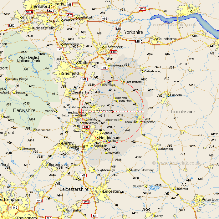
Nottinghamshire Map Showing Location of Bilsthorpe
Population: 3264
Area Size (ha): 82
District: Newark and Sherwood
Easting: 464666 Northing: 360040
Latitude: 53.13 Longitude: -1.03
 = Bilsthorpe
Area Size (ha): 82
District: Newark and Sherwood
Easting: 464666 Northing: 360040
Latitude: 53.13 Longitude: -1.03
= Bilsthorpe
This Bilsthorpe map below is supplied by Google. Use the tools in the top left corner to zoom into street level or zoom out for a road map, you may also need to zoom in to see Bilsthorpe on the map. Click and drag the map to move around. If the map fails to load try and refresh your browser or zoom in or out (+ or -).
Update - it seems Google no longer allow people to use their maps for free! This Bilsthorpe map sometimes loads and sometimes gives a error. I am working on a solution.
Closest 30 Towns or Cities to Bilsthorpe (Population over 500)
Farnsfield 3.7km Clipstone 5.79km Rainworth 5.86km Edwinstowe 5.99km Southwell 7.71km Boughton 7.88km Blidworth 8.69km Ollerton 9.34km Oxton 9.53km Warsop 10.75km Mansfield 11.12km Walesby 11.61km Claverton 11.61km Calverton 11.61km Mansfield Woodhouse 11.72km Fiskerton 12.85km Fiskerton Ferry 12.85km Bleasby 12.97km Woodborough 13.16km Tuxford 13.64km Papplewick 13.64km Newstead 14.31km Muskham 14.57km North Muskham 14.57km Pleasley 14.92km Farndon 15.35km Elkesley 15.48km Elksley 15.48km Sutton in Ashfield 15.68km Newark 16.25km