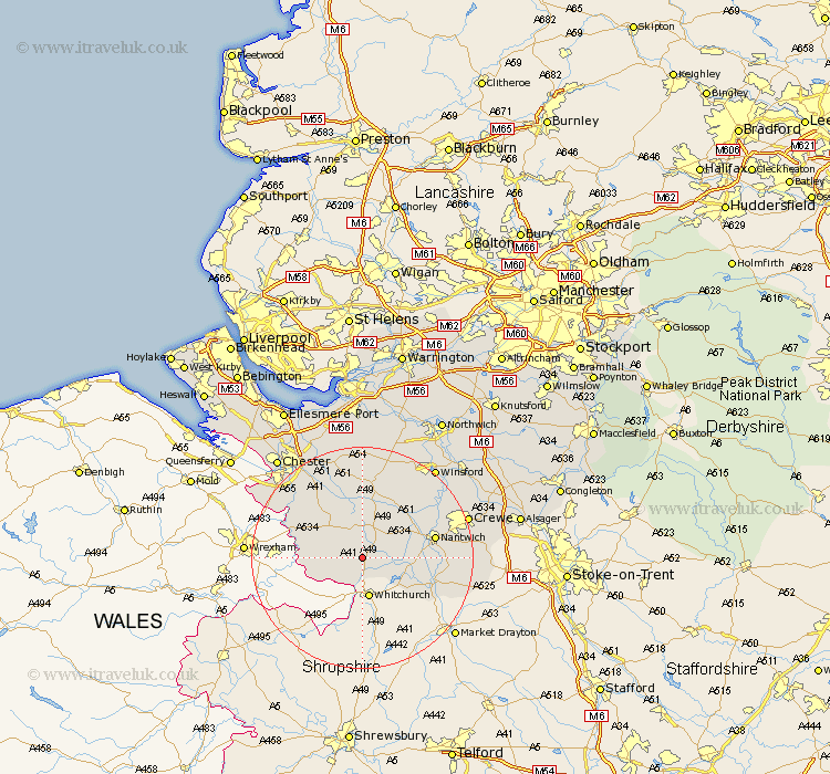
Cheshire Map Showing Location of Bickley
Population: 498
District: Chester
Easting: 353063 Northing: 348709
Latitude: 53.03 Longitude: -2.7
 = Bickley
District: Chester
Easting: 353063 Northing: 348709
Latitude: 53.03 Longitude: -2.7
= Bickley
This Bickley map below is supplied by Google. Use the tools in the top left corner to zoom into street level or zoom out for a road map, you may also need to zoom in to see Bickley on the map. Click and drag the map to move around. If the map fails to load try and refresh your browser or zoom in or out (+ or -).
Update - it seems Google no longer allow people to use their maps for free! This Bickley map sometimes loads and sometimes gives a error. I am working on a solution.
Closest 30 Towns or Cities to Bickley (Population over 500)
Malpas 4.83km Harthill 6.49km Wrenbury 6.94km Wrenbury cum Frith 6.94km Tilston 8.02km Bunbury 9.86km Tattenhall 10.29km Nantwich 12.81km Tarporley 13.17km Farndon 13.45km Audlem 13.47km Willaston 14.95km Waverton 16.27km Wistaston 16.56km Wybunbury 16.72km Little Budworth 17.97km Christleton 18.9km Tarvin 19.06km Crewe 19.3km Great Barrow 19.7km Barrow 19.7km Dodleston 20.06km Kelsall 20.42km Kelshall Hill 20.42km Kelsall Hill 20.42km Ashton 20.51km Delamere 20.51km Winsford 20.69km Mickle Trafford 21.83km Whitegate 22.72km