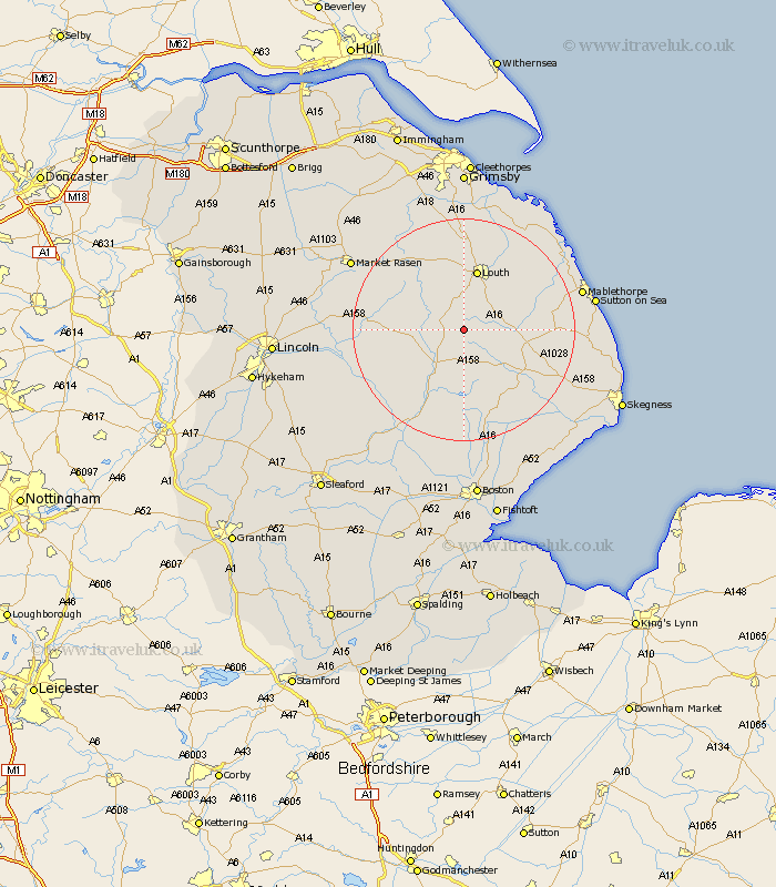
Lincolnshire Map Showing Location of Belchford
Population: 273
District: East Lindsey
Easting: 530037 Northing: 376216
Latitude: 53.27 Longitude: -0.05
 = Belchford
District: East Lindsey
Easting: 530037 Northing: 376216
Latitude: 53.27 Longitude: -0.05
= Belchford
This Belchford map below is supplied by Google. Use the tools in the top left corner to zoom into street level or zoom out for a road map, you may also need to zoom in to see Belchford on the map. Click and drag the map to move around. If the map fails to load try and refresh your browser or zoom in or out (+ or -).
Update - it seems Google no longer allow people to use their maps for free! This Belchford map sometimes loads and sometimes gives a error. I am working on a solution.
Closest 30 Towns or Cities to Belchford (Population over 500)
Banovallum 8.64km Horncastle 8.64km Mareham 9.34km Mareham-on-the-Hill 9.34km Mareham on the Hill 9.34km Legbourne 9.95km Louth 11.34km Spilsby 13.63km Grimoldby 14.22km Manby 14.93km Alford 15.63km Wragby 16.73km Woodhall Spa 17.08km Willoughby 17.54km Coningsby 18.4km Bardney 18.6km Holton 19.2km Carrington 20.39km Fulstow 20.5km binbrook 20.53km Stickney 20.87km Tattershall 21.06km Huttoft 21.15km Mablethorpe 21.27km Saltfleetby St. Clement 21.44km Saltfleetby St Clement 21.44km Saltfleetby Saint Clement 21.44km Saltfleetby 21.44km North Thoresby 22.24km Saltfleet 22.76km