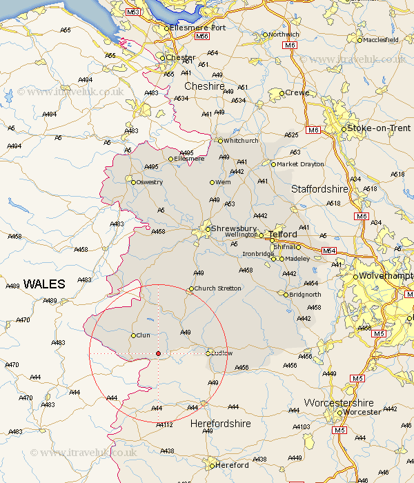
Shropshire Map Showing Location of Bedstone
Population: 192
District: South Shropshire
Easting: 336458 Northing: 274746
Latitude: 52.37 Longitude: -2.93
 = Bedstone
District: South Shropshire
Easting: 336458 Northing: 274746
Latitude: 52.37 Longitude: -2.93
= Bedstone
This Bedstone map below is supplied by Google. Use the tools in the top left corner to zoom into street level or zoom out for a road map, you may also need to zoom in to see Bedstone on the map. Click and drag the map to move around. If the map fails to load try and refresh your browser or zoom in or out (+ or -).
Update - it seems Google no longer allow people to use their maps for free! This Bedstone map sometimes loads and sometimes gives a error. I am working on a solution.
Closest 30 Towns or Cities to Bedstone (Population over 500)
Bucknell 1.13km Clun 8.77km Craven Arms 10.04km North Lydbury 11.18km Lydbury North 11.18km Wistanstow 12.47km Ludlow 13.58km Caynham 18.2km Diddlebury 18.43km Bitterley 19.58km Rushbury 22.22km Church Stretton 22.29km Shelve 24.32km Chirburg 26.14km Chirbury 26.14km Ditton Priors 28.94km Minsterley 29.64km Cleobury Mortimer 30.6km Pontesbury 31.68km Condover 33.86km Westbury 35.22km Berrington 35.24km Kinlet 35.5km Baystonhill 35.59km Great Hanwood 36.08km Hanwood 36.08km Cressage 36.58km Much Wenlock 36.7km Highley 38.44km Alberbury 38.94km