Suffolk Map Showing Location of Bedfield
Population: 298
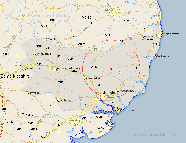
District: Mid Suffolk
Easting: 621818 Northing: 266334
Latitude: 52.25 Longitude: 1.25
 = Bedfield
District: Mid Suffolk
Easting: 621818 Northing: 266334
Latitude: 52.25 Longitude: 1.25
= Bedfield
This Bedfield map below is supplied by Google. Use the tools in the top left corner to zoom into street level or zoom out for a road map, you may also need to zoom in to see Bedfield on the map. Click and drag the map to move around. If the map fails to load try and refresh your browser or zoom in or out (+ or -).
Update - it seems Google no longer allow people to use their maps for free! This Bedfield map sometimes loads and sometimes gives a error. I am working on a solution.
Closest 30 Towns or Cities to Bedfield (Population over 500)
Worlingworth 1.86km Dennington 3.88km Debenham 5.86km Framlingham 6.78km Stradbroke 7.5km Thorndon 8.76km Laxfield 9.69km Eye 10.06km Otley 11.18km Fressingfield 11.63km Hoxne 11.63km Mendlesham 12.48km Wickham Market 13.67km Gislingham 14.7km Cookley 15.49km Coddenham 15.84km Bacton 15.99km Henley 16.31km Ufford 16.31km Old Newton 16.32km Grundisburgh 16.68km Melton 17.29km Woodbridge 17.29km Wirnesham 17.29km Witnesham 17.29km Saxmundham 17.42km Wortham 17.57km Yoxford 18.25km Botesdale 18.38km Haughley 18.53km