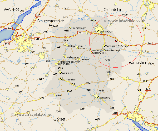
Wiltshire Map Showing Location of Baydon
Population: 525
District: Kennet
Easting: 427772 Northing: 176168
Latitude: 51.48 Longitude: -1.6
 = Baydon
District: Kennet
Easting: 427772 Northing: 176168
Latitude: 51.48 Longitude: -1.6
= Baydon
This Baydon map below is supplied by Google. Use the tools in the top left corner to zoom into street level or zoom out for a road map, you may also need to zoom in to see Baydon on the map. Click and drag the map to move around. If the map fails to load try and refresh your browser or zoom in or out (+ or -).
Update - it seems Google no longer allow people to use their maps for free! This Baydon map sometimes loads and sometimes gives a error. I am working on a solution.
Closest 30 Towns or Cities to Baydon (Population over 500)
Aldbourne 2.18km Ramsbury 5.56km Bishopstone 6.02km Chiseldon 8.29km Wanborough 8.88km Marlborough 10.96km Bedwyn 12.97km Great Bedwyn 12.97km Wroughton 13.22km Swindon 15.08km Stratton St Margaret 15.21km Stratton St. Margaret 15.21km Stratton Saint Margaret 15.21km Stratton 15.21km Shalbourn 15.22km Shalbourne 15.22km Broad Hinton 16.16km Highworth 16.37km Grafton 16.84km Burbage 17.31km Broad Town 18.47km Blunsdon 18.97km Blunsdon St Andrew 18.97km Blunsdon St. Andrew 18.97km Blunsdon Saint Andrew 18.97km Pewsey 19.66km Lydiard Millicent 20.65km Wootton Bassett 21.49km Wooton Bassett 21.49km Purton 21.54km