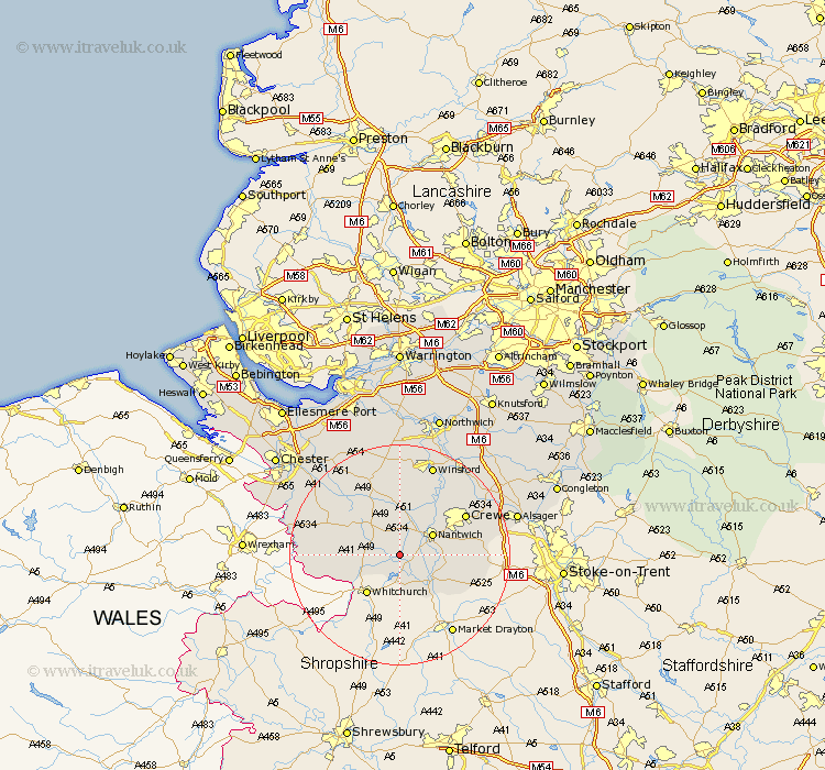
Cheshire Map Showing Location of Baddiley
Population: 226
District: Crewe and Nantwich
Easting: 359768 Northing: 348648
Latitude: 53.03 Longitude: -2.6
 = Baddiley
District: Crewe and Nantwich
Easting: 359768 Northing: 348648
Latitude: 53.03 Longitude: -2.6
= Baddiley
This Baddiley map below is supplied by Google. Use the tools in the top left corner to zoom into street level or zoom out for a road map, you may also need to zoom in to see Baddiley on the map. Click and drag the map to move around. If the map fails to load try and refresh your browser or zoom in or out (+ or -).
Update - it seems Google no longer allow people to use their maps for free! This Baddiley map sometimes loads and sometimes gives a error. I am working on a solution.
Closest 30 Towns or Cities to Baddiley (Population over 500)
Wrenbury cum Frith 1.85km Wrenbury 1.85km Nantwich 6.7km Audlem 7.87km Willaston 8.64km Bunbury 9.86km Wybunbury 10.03km Wistaston 10.5km Malpas 11.3km Harthill 11.46km Crewe 13.38km Tarporley 13.72km Tattenhall 14.49km Tilston 14.6km Little Budworth 16.68km Winsford 17.58km Sandbach 19.14km Farndon 19.73km Waverton 19.96km Middlewick 20.05km Middlewich 20.05km Whitegate 20.66km Delamere 20.87km Kelsall Hill 21.14km Kelshall Hill 21.14km Kelsall 21.14km Alsager 21.37km Tarvin 21.62km Cuddington 22.24km Ashton 22.25km