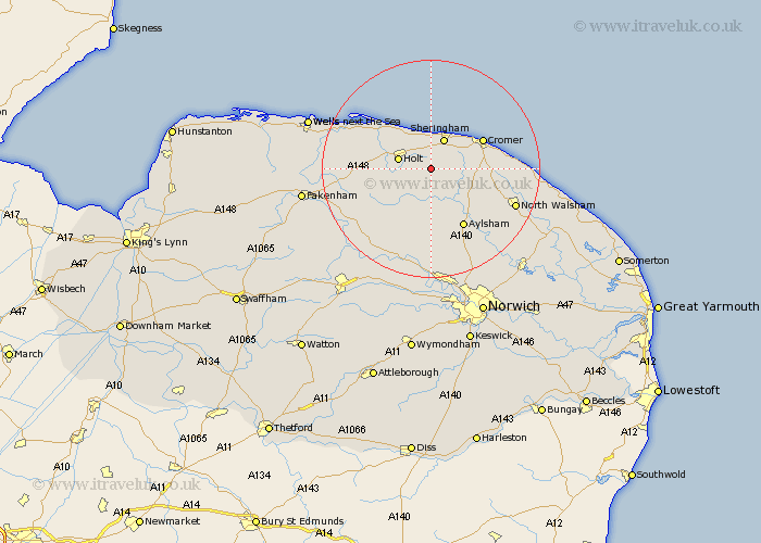
Norfolk Map Showing Location of Baconsthorpe
Population: 232
District: North Norfolk
Easting: 613039 Northing: 336492
Latitude: 52.88 Longitude: 1.17
 = Baconsthorpe
District: North Norfolk
Easting: 613039 Northing: 336492
Latitude: 52.88 Longitude: 1.17
= Baconsthorpe
This Baconsthorpe map below is supplied by Google. Use the tools in the top left corner to zoom into street level or zoom out for a road map, you may also need to zoom in to see Baconsthorpe on the map. Click and drag the map to move around. If the map fails to load try and refresh your browser or zoom in or out (+ or -).
Update - it seems Google no longer allow people to use their maps for free! This Baconsthorpe map sometimes loads and sometimes gives a error. I am working on a solution.
Closest 30 Towns or Cities to Baconsthorpe (Population over 500)
Weybourne 5.67km Holt 5.89km Sheringham 5.99km Briston 7.67km Corpusty 7.74km Runton 7.88km West Runton 7.88km Erpingham 7.89km Roughton 8.95km Melton Constable 9.69km Mellon Constable 9.69km Cromer 10.53km Northrepps 11.33km Aylsham 12.45km Hindolveston 12.5km Overstrand 12.84km Cawston 12.97km Marsham 14.12km Blakeney 14.52km Felmingham 14.53km Foulham 15.01km Foulsham 15.01km Reepham 15.2km Trunch 16.09km Hevingham 16.27km North Walsham 16.33km Mundesley 16.88km Mundersley 16.88km Witchingham 17.01km Little Snoring 18.28km