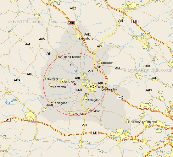
Oxfordshire Map Showing Location of Eynsham
Population: 4672
Area Size (ha): 102
District: West Oxfordshire
Easting: 442550 Northing: 207788
Latitude: 51.77 Longitude: -1.38
 = Eynsham
Area Size (ha): 102
District: West Oxfordshire
Easting: 442550 Northing: 207788
Latitude: 51.77 Longitude: -1.38
= Eynsham
This Eynsham map below is supplied by Google. Use the tools in the top left corner to zoom into street level or zoom out for a road map, you may also need to zoom in to see Eynsham on the map. Click and drag the map to move around. If the map fails to load try and refresh your browser or zoom in or out (+ or -).
Update - it seems Google no longer allow people to use their maps for free! This Eynsham map sometimes loads and sometimes gives a error. I am working on a solution.
Closest 30 Towns or Cities to Eynsham (Population over 500)
Cassington 2.94km Hanborough 3.7km Church Handborough 3.7km Stanton Harcourt 3.89km North Leigh 5.05km Bladon 6.01km Standlake 6.02km Cumnor 6.54km Yarnton 6.82km Witney 7.12km Ducklington 7.13km Hailey 7.81km North Hinksey 7.82km Stonesfield 8.16km Kidlington 8.84km Oxford 9.36km Wootton 9.38km Longworth 9.89km Woodstock 10.33km Minster Lovell 10.96km Kingston Bagpuze 11.35km Kingston Bagpuize 11.35km Sunningwell 11.55km Islip 11.72km Leafield 11.72km Bampton 11.73km Tackley 12.03km Bletchingdon 12.25km Charlbury 12.51km Brize Norton 12.62km