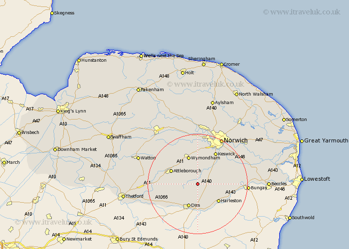
Norfolk Map Showing Location of Aslacton
Population: 416
District: South Norfolk
Easting: 615076 Northing: 290174
Latitude: 52.47 Longitude: 1.17
 = Aslacton
District: South Norfolk
Easting: 615076 Northing: 290174
Latitude: 52.47 Longitude: 1.17
= Aslacton
This Aslacton map below is supplied by Google. Use the tools in the top left corner to zoom into street level or zoom out for a road map, you may also need to zoom in to see Aslacton on the map. Click and drag the map to move around. If the map fails to load try and refresh your browser or zoom in or out (+ or -).
Update - it seems Google no longer allow people to use their maps for free! This Aslacton map sometimes loads and sometimes gives a error. I am working on a solution.
Closest 30 Towns or Cities to Aslacton (Population over 500)
Moulton 1.13km Great Moulton 1.13km Moulton St Michael 1.13km Moulton St. Michael 1.13km Moulton Saint Michael 1.13km Bunwell 2.92km Forncett 4.34km Forncett St. Mary 4.34km Forncett St Mary 4.34km Forncett Saint Mary 4.34km Long Stratton 4.88km Ashwellthorpe 7.49km Burston 7.5km Pulham 7.93km Old Buckenham 8.11km Banham 9.22km Hempnall 9.76km Diss 9.87km Saxlingham 10.03km Saxlingham Thorpe 10.03km Mulbarton 10.3km Besthorpe 10.6km Harleston 10.84km Scole 11.12km Attleborough 11.58km Wymondham 11.62km Roydon 12km Swardeston 12.47km Quidenham 12.56km Stoke Holy Cross 12.93km